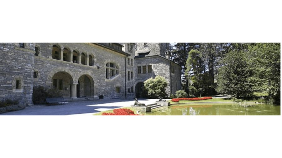
No. 27366
Château Mercier
Switzerland
ChâteauIntactFor events20th century
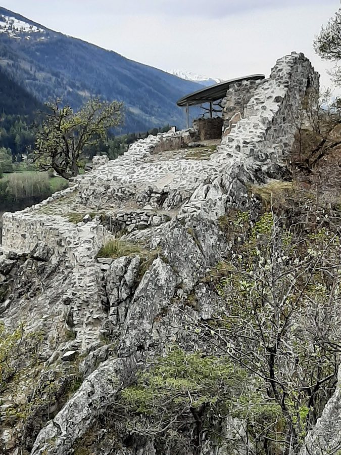
No. 74807
Castle · Switzerland
No. 74807 · 46.278 N, 7.552 E
For events
Beauregard Castle is marked as a château or castle venue lead. Capacity, indoor/outdoor spaces, catering rules, and accommodation options are published only after public verification.
Event types: Private events, Cultural gatherings, Filming and photography
Quick summary
Beauregard Castle is a castle in Switzerland with origins associated with the 6th century.
See all castles in SwitzerlandBeauregard Castle in the municipality of Chippis, Switzerland, was erected in the medieval period by local feudal builders, though its exact founding date is uncertain.
The earliest phase of the site is debated, with one view placing construction in 1097 while stylistic comparison points to the twelfth century. Documentary evidence records the place under the names bel regard in 1457 and Perigard in 1545, showing how its name changed over time.
By the fourteenth century the site belonged to the de Raron family. Peter of Raron is associated with the castle before 1380; after marrying Beatrice he bought the Val d’Anniviers estate for 1,700 florins. In October 1387 Amadeus VII laid siege to the stronghold as part of reprisals against the Raron uprising, captured it, and the fortifications suffered damage. Peter’s sons Petermann and Heinzmann were taken prisoner and hanged in Sion. The de Raron household repaired the damage soon afterward.
During the conflict known as the Raron affair around 1416–1417 the castle endured a prolonged siege. Defenders surrendered after suffering hunger and thirst, the site was set on fire, and it was never rebuilt for occupation thereafter. Witschard of Raron was exiled after these events and was restored to holdings in Anniviers in 1420.
Modern investigation of the ruin began in the mid twentieth century and intensified in the early twenty‑first. A survey was made in 1951 that regarded the remains as a watchtower. Proposals for excavation were advanced in 2005 and a foundation involving Swiss Heritage and the communes of Chippis and Sierre was formed to raise funds. A field sondage took place in 2008 and full excavations were conducted from 2009 to 2011 under the direction of Alessandra Antonini; the excavation lowered the visible site level by about nine metres and the work cost approximately 600,000 Swiss francs. Conservation works followed: the cistern was covered and the spiral stairwell given a roof in 2016, and a didactic path and a via ferrata providing access across the natural fault were completed in 2017.
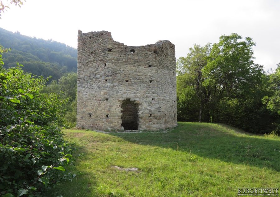
The ruined site occupies a rocky spur guarding the entrance to the Val d’Anniviers and is separated from the main path by a natural fault. The spur sits at roughly 1,012 metres above sea level and stands about 500 metres above the village of Chippis. The overall preserved area measures about thirty metres by twenty metres, and the principal stone dwelling forms a rectangle of roughly eight by nine metres. Masonry and timber were combined in the original build and in later additions, with wood used for upper‑level rooms and stone for foundations and service structures.
Approach to the site was controlled by a wooden bridge spanning a defensive moat. The bridge measured about two metres across and nine metres long, its center supported on uprights set into the rock and its deck designed to be dismantled. An eastern wall three to four metres high stood at the spur mouth and acted as an initial gate controlling access to the bridge. Notches cut into the eastern rock show where horizontal beams once sat, and a short stair sequence, made of a landing and four steps, led from the bridge up to the main gate.
The courtyard was arranged on two levels. An eastern lower court served as the guardroom and entrance corridor and varied between about 1.6 and three metres in width. A gate separated the lower court from the upper court; archaeological evidence indicates that this dividing gate was probably added after the assault of 1387.
Water supply was provided by a circular cistern that survives in archaeological form. The cistern is 2.25 metres deep, with a base diameter of 2.10 metres and a neck of 1.90 metres, giving an estimated capacity near six thousand litres. Its floor is made of five slabs of slate schist, while the vertical walls were formed of rauhwacke (a local carbonate rock) blocks with an inner lining of olive‑green clay silt to make them watertight. Surplus water was carried away by a small channel built of rauhwacke blocks to the east. The round cistern was constructed within an earlier rectangular tank, and the circular form was already present by 1387. The cistern was covered in 2016 to protect it and to prevent leaf build‑up and accidental falls.
The main stone building shows deliberate defensive and domestic planning. The north wall contains two openings: a narrow firing slit and a second opening set about seventy centimetres lower, and wall thicknesses measure roughly 1.6 metres on the north and west sides and about 2.5 metres on the east side. The eastern wall faces the natural moat and was built with a sloping earthwork on its outer face. A spiral stairwell provided vertical circulation to the west entrance of the dwelling, to the upper terrace, and to an upper floor; archaeological traces demonstrate that the spiral stairwell was a later insertion into the plan. Remains of door beam sockets are visible at the western entry. The stairwell was given a protective roof in 2016.
A later wooden superstructure occupied the upper terrace and comprised two rooms of about twenty‑four square metres each. One room stood against the main stone building and was reached by a north staircase beside the cistern; the other room was entered from the spiral stairwell, and its south‑west corner is built more massively where it bridged the terrace and cistern levels. Excavation revealed an intact cannonball among the fallen upper‑floor beams in 2010; its position shows it had been stored on the upper floor, and the upper floor may have functioned as a defensive platform. A layer of ash in the spiral stairwell records that that stair area was burned.
A small stair on the south‑west side led up to a rectangular tower measuring about three by five metres. The tower’s lower floor was used for storage and the second floor commanded the south‑west ridge. The access stair continues past the tower to a postern, which provided a secondary exit onto a steep path running along the south‑west edge of the spur. These ancillary elements remain as fragmentary stonework and carved steps in situ.
Archaeological excavation between 2009 and 2011 exposed the structural remains and clarified the sequence of building, modification, burning, and abandonment. Conservation works since then have protected key elements of the ruin, notably the cistern and the stair enclosure, while paths and a protected crossing were added to secure general access to the spur.
No. 27366
No. 20270
No. 40370
No. 16054
Comments
Comments for Beauregard Castle will require a verified account before posting.
We'll send a verification link before your first comment is published.