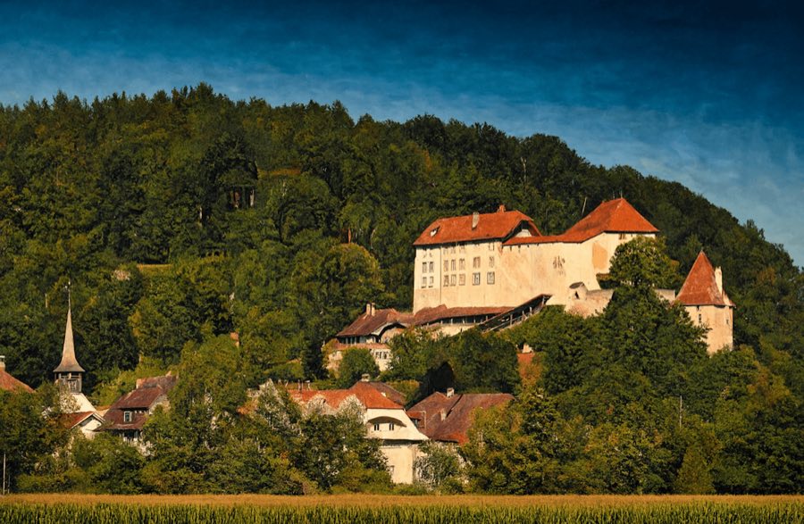
No. 86946
Laupen Castle
Switzerland
CastleRestored12th century
No. 18416
No. 18416 · 46.984 N, 7.262 E
Quick summary
Burg Oltigen is a castle in Switzerland with origins associated with the 11th century.
See all castles in SwitzerlandBurg Oltigen stands above the Aare in the municipality of Radelfingen and was built and held by local medieval nobles. The site first appears in written records in 1006. In the eleventh century members of the castle family held comital rank; Kuno I of Oltigen is recorded in connections with Count Giselbert of Luxembourg and later generations were allied by marriage to Rainald II of Burgundy. Kuno II and his brother Burkhard, called Bukko, are associated with the place; Burkhard served as Bishop of Lausanne from 1056 to 1089 and after his journey to Canossa in 1077 he held the office of Imperial Chancellor of Italy.
Between about 1075 and 1125 Burg Oltigen reached its greatest strategic role during the Investiture Controversy, when control of Alpine crossings was contested between imperial and papal factions. During these decades the lords of Oltigen used a comital title and at times extended influence into territory of the Bishopric of Lausanne. The settlement of 1122 removed the immediate strategic reasons for the castle’s prominence.
By around 1400 the lordship based on the castle included extensive nearby settlements, covering much of what is today Wohlen (Oberdettigen, Unterdettigen, Innerberg, Uettligen, Möriswil and Säriswil) and parts of neighbouring communities such as Frieswil in Seedorf, along with areas of Meikirch and Radelfingen. In the mid fourteenth century Johann III von Bubenberg served as the Kyburg bailiff at Oltigen from 1346 to 1348. In May 1410 a peasant uprising destroyed the castle and the last count, Hugo von Mömpelgard, was killed. After that event the city of Bern took control of the lordship and administered it as a bailiwick until 1483, when the territory was divided between the bailiwicks of Aarberg and Laupen.
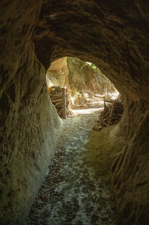
In 1850 the remaining masonry was dismantled and the stones were reused for local building. During the First World War soldiers cut a cave through the rock ridge beneath the former castle mound between 1914 and 1918 to serve as an observation post; the excavated shelter is known locally as Güggelisloch.
The castle occupied a narrow rock band about ninety metres above the Aare, beneath the confluence of the Saane, and commanded the river ford at that point. The ridge dictated the layout, with fortifications built along the natural rock spine. The Aare in this stretch is now impounded by the Niederriedsee, which has altered the modern waterline below the former site.
Documentary and antiquarian evidence shows that the surviving masonry was taken down in 1850 and the stones removed for reuse, so there are no substantial standing wall faces from the medieval period. Beneath the former castle mound a rock-cut cave was opened during 1914–1918 by soldiers and served as an observation post; this later modification survives under the hill and is locally known as Güggelisloch.
No. 86946
No. 49965
No. 31159
No. 59747
Comments
Comments for Burg Oltigen will require a verified account before posting.
We'll send a verification link before your first comment is published.