No. 48006
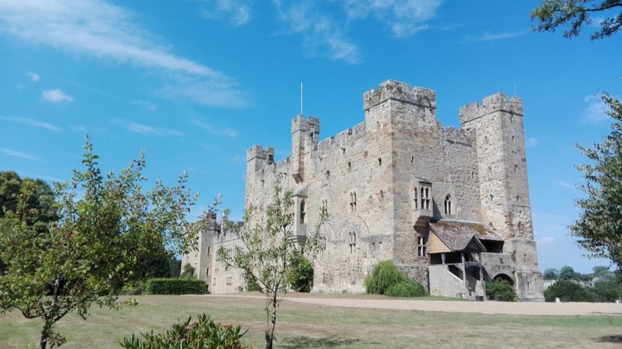
Haughton Castle
United Kingdom
Manor houseRuin13th century
No. 37207
Castle · United Kingdom
No. 37207 · 55.153 N, 2.355 W
Quick summary
Dally Castle is a castle in United Kingdom with origins associated with the 13th century.
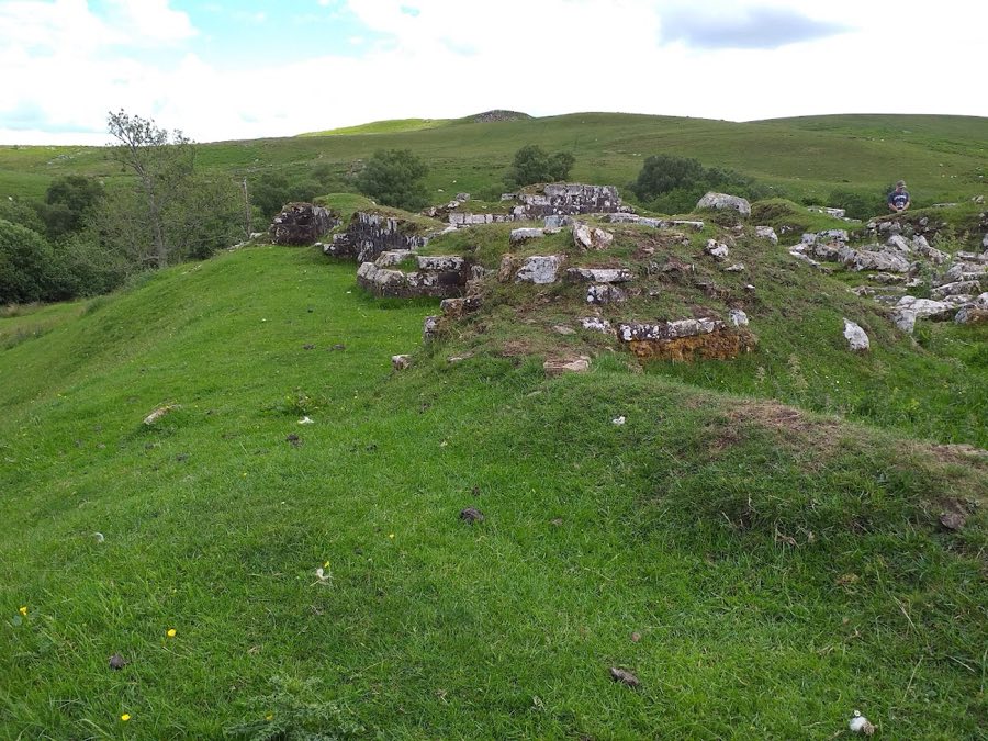
See all castles in United KingdomDally Castle stands at Dally Castle, Hexham, United Kingdom, and was erected in the thirteenth century for a member of the Lindsay family, recorded as David de Lindsay or a namesake.
The site first appears in records in 1237 and has been linked, without firm proof, to a contemporaneous mention of a tower-like house being built in Tynedale for David de Lindsay. By 1289 the fortress had been taken into royal custody by King Edward I. In 1296 the king granted the property to John Swinburne. Around 1300 the stronghold was altered into a three-storey tower-house, with square towers placed at three corners.
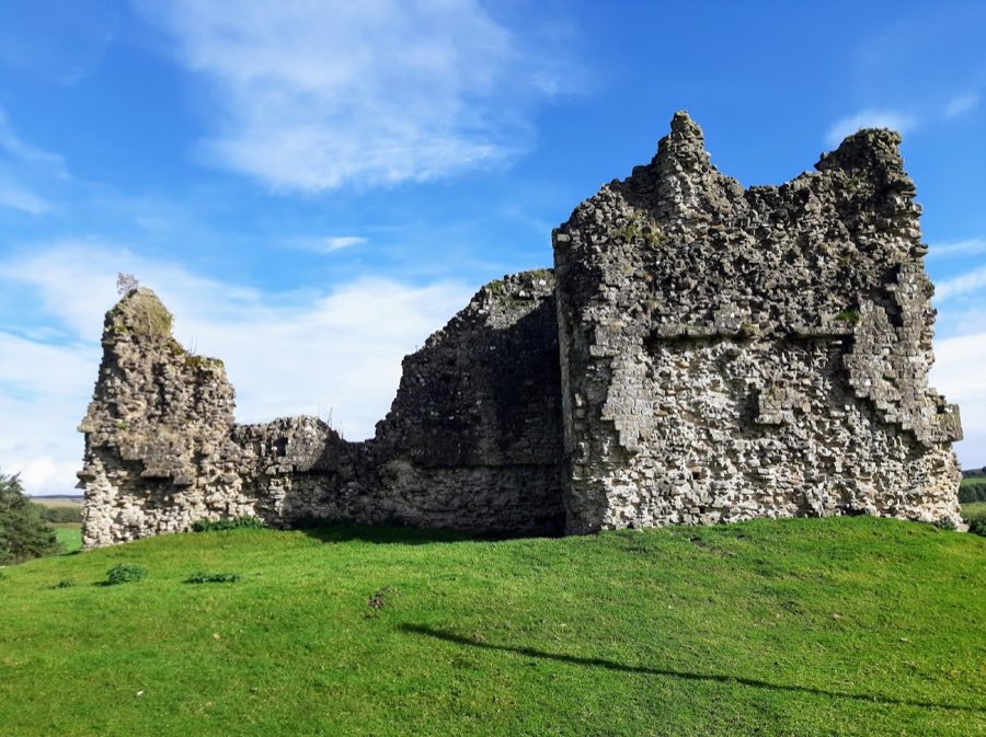
In 1326 the castle is listed as held by the Crown under King Edward II, and it was burned by Scottish raiding forces during cross-border incursions that year. Occupation of the building continued into the sixteenth century or later, a conclusion supported by finds recovered from debris beneath the north-west turret in 1888, including a helmet, a sword point, and tobacco pipes. By the reign of James I the structure had become ruinous. During the eighteenth century the remaining roofless walls fell inward and many stones were taken for local building projects, among them Dally Mill, leaving only foundations visible in one later account.
Ownership of the surrounding estate changed hands several times. In 1664 William Charlton of the Bower bought it from the Earl of Suffolk. Records note the Dodds family as owners in 1604, and in 1841 the property passed to Sir Edward Haggerston. In 1888 W. L. Charleton cleared collapsed material and exposed standing fabric; several carved columns removed at that time were used to build a piggery, and an Early English pierced chimney head discovered during that work was taken away. A plan published around 1905 did not accurately record the remains.
The castle occupies the narrow summit of a steep-sided ridge cut through at its eastern end by the Chirdon Burn. Builders isolated the eastern portion by cutting a gap, while the western end looks down to a larger ditch. The plan of the fortification combines two principal blocks. A small east building, oriented differently and measuring about 30 by 15 feet, stands apart from the main block and has been interpreted as either a barn or a chapel. East of the eastern ditch, masonry traces survive on a low mound that correspond with these extra foundations.
The principal block is an oblong structure with internal dimensions of roughly 56 feet 6 inches by 26 feet 8 inches, constructed of rubble set in mortar with ashlar facing in places. Two turrets were attached at the northern corners, and a larger south-side wing or turret stood at the south, although that southern element has largely disappeared leaving only short bonded wall lengths. A north-west turret survives with internal measurements near 9 feet 7 inches by 13 feet 10 inches and walls about 4 feet 6 inches thick; its external base course joins the main building’s base in an irregular manner. A north-east turret is recorded as a later addition.
The main walls are substantial, around 5 feet 9 inches to 6 feet thick, and contain narrow, fish-tail shaped loopholes about two inches wide. Some loopholes were carefully built up with ashlar-faced stone and with triangular blocks cut to fit the angled embrasures. An opening in the east gable was partly kept and later repurposed as a small cupboard. On the south front a formerly defensive slit was altered into a barred window set within a rounded quarter moulding. A narrow entrance in the south-west corner, with chamfered jambs and sill, gives access to what the record describes as either a mural stair or a small turret. Adjacent to that doorway a later fireplace was inserted to block an earlier embrasure; the fireplace carries a projecting hood supported on a pair of plain, splayed corbels.
Interior construction shows timber and stone working together. The ground floor once stood on central pillars that supported a longitudinal beam carrying the first-floor joists; those joists slid into 3¾-inch-wide runners set on corbels. The upper floor featured a central colonnade with responds at each end, which supported either stone arches or a timber roof frame. At the west end of the first floor a fireplace stood between detached columns with moulded capitals and bases, and a neat chimney head with four small smoke outlets is recorded. Later defensive work raised protection to crenellated parapets at roof level, and several short stone channels about 12½ inches wide relate to that parapet work. A stout wall, approximately 28 inches thick, descended from the south-east corner down the scarp toward the surrounding ditch.
Construction employed thin, flat-bedded rubble laid in mortar, with ashlar dressings where fine finish was required. Many blocks were removed during the eighteenth century for reuse in nearby structures, leaving foundation courses and some standing masonry. To the south of the site a farmhouse called Dally Castle House was erected in the eighteenth century adjacent to the ruins. Across the road stands a small flour mill that served for grinding wheat during the Napoleonic Wars. East of the castle additional foundation remains include one interpreted as a chapel and another as a small square dwelling. The fabric exposed in 1888 yielded metal and ceramic finds beneath the north-west turret, and during that clearance carved columns and a pierced chimney head were taken away for reuse elsewhere.
No. 48006
No. 29712
No. 63781
No. 65086
Comments
Comments for Dally Castle will require a verified account before posting.
We'll send a verification link before your first comment is published.