
No. 78726
Tomen yr Allt
United Kingdom
CastleRuin12th century
No. 27475
Castle · United Kingdom
No. 27475 · 52.688 N, 3.287 W
Quick summary
Mathrafal is a castle in United Kingdom with origins associated with the 6th century.
See all castles in United KingdomMathrafal stands in the community of Meifod in the United Kingdom and was established by the medieval rulers of the kingdom of Powys.
An earlier defended place stood nearby, and the site of Mathrafal became the principal seat of the kings and princes of Powys probably from the ninth century. It served as the administrative centre for the cantref of Caereinion and remained the kingdom’s focal place until the mid and late medieval changes in Powys. Around 520, or by about 656 at the time of the fall of the neighbouring kingdom of Pengwern, regional power shifted in this landscape and an earlier hill fort to the north‑west was used before Mathrafal rose to prominence.
Following the division of Powys in 1160, Mathrafal became the chief centre for the southern portion that later took the name Powys Wenwynwyn. Around the end of the twelfth century a large earthwork motte was constructed at the site; this work may have been carried out by the prince and poet Owain Cyfeiliog near 1170, or alternatively the motte may have been raised by Robert de Vieuxpont acting for King John in 1212. In 1212 Prince Gwenwynwyn ab Owain removed his seat from Mathrafal to Welshpool, also known by its Welsh name Y Trallwng.
In 1212 Robert de Vieuxpont was besieged in the castle by a combined force led by Gwenwynwyn and Llywelyn the Great, and King John intervened to relieve the garrison. The stronghold was destroyed in the fighting and was not rebuilt; some accounts record the destruction taking place in 1213 at the hands of Llywelyn the Great. Archaeological fieldwork at the site was undertaken by the University of York around 1991, which examined the surviving earthworks and found evidence relating to the site’s occupation and use.
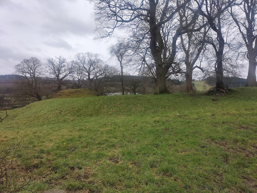
Mathrafal survives as a roughly rectangular defended compound about ninety metres by eighty metres, set beside the River Banwy where it meets the River Vyrnwy. Three sides of the enclosure are protected by an earthen bank with an outer ditch, while the river provided the fourth natural boundary. Little remains of masonry walls within the compound.
The motte is a prominent feature within the enclosure; it stands at about five metres in height and measures in the order of thirty‑five by twenty‑five metres across its base and summit. The motte dates to around the end of the twelfth century and is attributed either to the activities of Owain Cyfeiliog circa 1170 or to construction by Robert de Vieuxpont on behalf of King John in 1212. The motte remains as an earthwork in situ.
Excavations around 1991 exposed structural and artefactual traces within the castle area. During those investigations an iron and bronze figurine representing St Gwynllyw, known as Woolos the Warrior, was recovered from a cavity in a window base, indicating a religious association within the occupied buildings. The compound’s banks and outer ditch survive as visible landscape features, while standing walling survives only in small fragments. The site likely superseded an earlier hill fort located about one kilometre to the north‑west, which is dated in records to roughly 656 or possibly to the period around 520 when the administrative centre moved from Wroxeter.
No. 78726
No. 54707
No. 14587
No. 59158
Comments
Comments for Mathrafal will require a verified account before posting.
We'll send a verification link before your first comment is published.