No. 94130
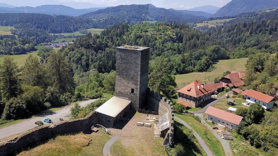
Burgruine Liebenfels
Austria
CastleRuin14th century
No. 32569
Castle · Austria
No. 32569 · 46.797 N, 14.346 E
Quick summary
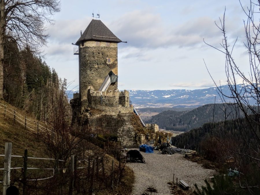
Ruinen der Kraiger Schlösser is a castle in Austria with origins associated with the 11th century.
See all castles in AustriaRuinen der Kraiger Schlösser is located in Frauenstein, Austria, and was built by medieval feudal lords of the Duchy of Carinthia.
Origins for the two neighbouring strongholds reach back to the high medieval period. A tower on a separated rock needle was erected in the 11th century and is said to have served as a fall-tower, a kind of prison tower. The earliest recorded member of the local ruling family appears in 1091 under the name Dietricus de Kriwig. Major building phases for the main castle complexes date to around the turn of the 12th to 13th centuries, and the pair formed part of a ring of fortifications north of the ducal town of St. Veit, positioned on the southern slope of the Kraiger Berg above the hamlet of Grassen between Schloss Frauenstein and the village of Kraig.
Members of the Kraig family served as ministeriales, unfree officials in ducal service, and their status rose over the centuries. From 1249 they held the office of steward. In the later medieval period they supplied provincial leaders, for example Konrad I from 1385, and the family received elevation to the rank of barons in 1466. The male line of the Carinthian branch ended in 1564. Ownership then passed through marriage and sale: the estates went to Johann Graf von Hardegg, then by Elisabeth’s marriage to Georg Graf von Nogaroll around 1566. In 1570 Archduke Karl sold the lands to Georg von Khevenhüller. In 1628 Paul Khevenhüller sold them to Ludwig Grotta von Grottenegg. During the 17th and 18th centuries the property moved among several families and since 1822 has belonged to the family Goëss.
The two castles ceased to function as active noble residences over time. Hochkraig was uninhabited from the mid-17th century, while Niederkraig remained in use by servants until the late 18th century; after that both strongholds fell into progressive decay. In the 20th and 21st centuries the ruins became legally protected heritage sites and were placed within a regional landscape protection area. An eight-by-eight metre swastika was added into the outer masonry of the higher tower at Hochkraig in 1934, was painted over after the Second World War, and was re-exposed in 2011. The nearby visible inscription “Heil Hitler” created public controversy, plans and funding were sought for cleaning and securing the ruins, and in 2017 funding of €60,000 was secured for remedial work. The wartime graphic was altered and the inscription was overpainted in 2019. The ruins are officially protected and are closed to public access for safety reasons.
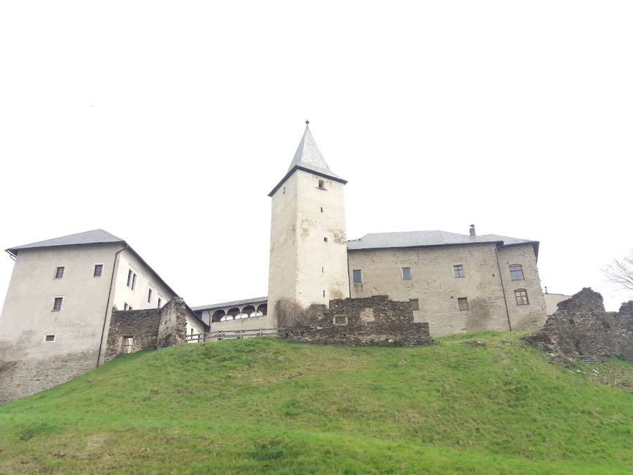
The site consists of two neighbouring medieval castle complexes on a rocky south-facing slope, connected visually and functionally across a narrow valley by a later masonry aqueduct. Construction combines Romanesque fortress work with Gothic and later additions, using rubble stone for high defensive walls and carefully cut stone for formal elements such as windows and chapel fittings. The layout places the smaller, higher castle on a steep crag and the larger group of buildings a short distance to the north on a projecting rock.
Hochkraig occupies a crag rising almost one hundred metres above the valley floor. Entrance was from the northwest over a flat forecourt separated from the main rock by a neck ditch roughly ten metres wide. A narrow, rock-cut path runs steeply around the eastern side of the outer wall to the north gate. Substantial remains include the thick-walled Romanesque defensive tower, a bergfried (a tall defensive tower) with notably rounded corners, set about one to two metres away from a six-metre-high rubble wall that once carried a battlemented walkway. A great hall was added in the 14th century and a lower chapel belongs to that same phase. Traces of an outer ward, Gothic residential and economic buildings, and a Gothic chapel survive in fragmentary but visible condition. About two hundred metres north of Hochkraig stands the small rock-needle tower dating to the 11th century, long described in local accounts as a prison tower.
Niederkraig comprises the larger and better-preserved complex, with most standing fabric from the late 14th century. Two square defensive towers remain; the northern tower retains funnel-shaped slits used for signalling or defence, while the southern tower rises five storeys and forms the nucleus around which 14th- and 15th-century Gothic additions group. A three-storey great hall from the 16th century is now reduced to a few wall fragments, but surviving white marble window surrounds attest to an ornate Renaissance phase. A round tower projecting from a southern rock was converted into a chapel in 1730 dedicated to Saint John of Nepomuk and served as a filial and pilgrimage chapel; this chapel contains numerous Roman-period spolia and carved reliefs and houses a 17th-century altar decorated with vine motifs together with 18th-century carved figures. Between the two castles a round-arched aqueduct, about forty metres long and ten metres high with four arches, spans the narrow valley; it dates to the 15th or 16th century and crosses the former line of a Roman road. The outer masonry of the Hochkraig tower at one time bore an eight-by-eight metre swastika; after cleaning and conservation work in recent years that Nazi-era graphic was altered and an adjacent “Heil Hitler” inscription was overpainted, so that the visible surface today differs from the wartime addition.
No. 94130
No. 83822
No. 68883
No. 13580
Comments
Comments for Ruinen der Kraiger Schlösser will require a verified account before posting.
We'll send a verification link before your first comment is published.