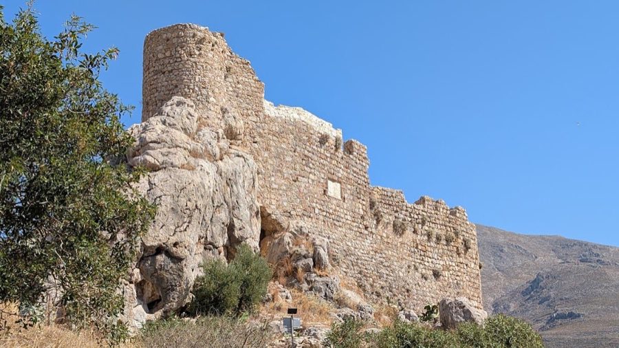
No. 66324
Chrysocheria Castle
Greece
CastleIntact15th century
No. 13451
Castle · Greece
No. 13451 · 36.803 N, 27.128 E
Quick summary
Antimachia Castle is a castle in Greece with origins associated with the 14th century.
See all castles in GreeceAntimachia Castle stands in the municipality of Antimachia, Greece, and was erected by the Knights Hospitaller in the 14th century. The fort occupies a hill that earlier held a Byzantine watchtower, and the site was chosen to control the southern part of Kos, the strait between Kos and Nisyros, and the island’s main north–south route while protecting nearby settlements including the former capital Neratzia.
The fortress was raised during the Hospitaller period, with one account assigning construction to Grand Master Helion de Villeneuve in the mid‑14th century and another giving a broader range within the same century. In 1383 an assembly of the order decided that the castle would serve as a prison for Hospitaller knights found guilty of serious offences, and the fortress thereafter held convicted members of the order.
In June 1457 the castle endured a prolonged Ottoman assault lasting twenty‑three days. Fifteen Hospitaller knights defended the place with the aid of roughly three hundred islanders. Fifteen of the defenders were killed. Contemporary tallies record about one thousand Ottoman dead and over two thousand wounded; after the siege Ottoman forces plundered buildings on the island and then withdrew.
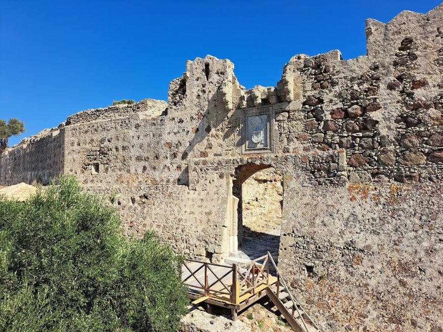
An earthquake in 1493 damaged the walls and work to repair the defences followed in 1494, marked by an inscription and the coat of arms of Grand Master Pierre d’Aubusson above the main gate. Early in the 1500s the north‑west entrance was reinforced with a semicircular, or horseshoe, bastion; this alteration is associated with Fabrizio del Carretto and has been dated by one account to 1520.
After the fall of Rhodes in 1522 the island passed into Ottoman hands and a small Ottoman garrison was stationed at the castle. That garrison remained until 1871. The inner settlement of the fortress was largely deserted in the nineteenth century, with one date for abandonment given as 1840. Two damaging earthquakes on 8 February 1926 and 23 April 1933 left the fortress walls and the surviving churches standing while many interior buildings were destroyed. The complex experienced several episodes of building and rebuilding under different grand masters and during Ottoman occupation, and one account divides its construction history into six distinct phases. At least one record indicates the fortress is accessible today.
The fort covers roughly 2.625 hectares and its curtain wall runs for about 970 metres, following the natural shape of the hill. Different plans describe the enclosure as an irregular quadrilateral or an irregular pentagon, but all agree that the walls track the plateau’s contours. Builders used large natural stones laid in courses and bonded with lime mortar, producing a layered, robust masonry that adapts to rock outcrops on the south and east sides and to level ground on the north, where the defences are more strongly formed.
The main entrance on the north‑west is protected by a semicircular bastion added in the early 1500s, placed before the gate to strengthen the approach. Above the inner gate a stone slab carries the arms of Grand Master Pierre d’Aubusson and the date 1494, a visible record of the post‑earthquake repairs. A cornice above the entrance suggests there were once openings for dropping projectiles onto attackers below, and the rampart is finished with crenellations and deep slanted embrasures that formed firing positions and parapet battlements.
The curtain is generally without major projecting towers; the defence relies on the continuous wall and its battlements rather than on large discrete towers. Southern and eastern stretches are founded directly on bedrock and mirror the surrounding relief, while the northern enceinte stands on flat ground and shows heavier fortification. Repairs and additions reflect multiple building phases, including the early 16th‑century reinforcement at the main gate, and later Ottoman alterations such as the replacement or erection of domestic and religious structures inside.
Within the enclosure two single‑nave churches survive. Agios Nikolaos has a single apse and preserves fragments of fresco painting dated to the 15th–16th centuries, while Agia Paraskevi carries a date of 1705. Ruined remains record the former church Panagia Eleimonitria and the base walls of a mosque from the Ottoman period, showing the site’s successive Christian and Ottoman religious uses. Several cisterns are visible, reflecting the need to collect and store water for the garrison and inhabitants, and foundations indicate the former layout of houses; aside from the two churches and some cisterns most interior buildings survive only as rubble and foundations.
Overall the fortress presents visible layers of its long history: medieval Hospitaller fabric and inscriptions at the gate, a 16th‑century bastion strengthening the entrance, Ottoman‑period domestic and religious traces, and masonry that bears the marks of earthquake damage and later repairs.
No. 66324
No. 93416
No. 93133
No. 60902
Comments
Comments for Antimachia Castle will require a verified account before posting.
We'll send a verification link before your first comment is published.