No. 21381
Castle of Numão
Portugal
CastleRuin18th century
No. 27861
Castle · Portugal
No. 27861 · 41.203 N, 7.305 W
Quick summary
Castle of Carrazeda is a castle in Portugal with origins associated with the 11th century.
See all castles in PortugalThe Castle of Carrazeda is located in the municipality of Carrazeda de Ansiães in Portugal. While the visible fortifications date mainly to the medieval period, the site has a long history beginning with human activity in the Chalcolithic era around 3000 BCE.
The area later developed into a Roman settlement, thriving during the Roman period until its destruction by northern barbarian groups around 409 CE. Centuries later, in 711 CE, Muslim forces captured the region and established an early fortified presence, contributing to the site’s initial defensive structures.
By the mid-11th century, control shifted to the Christian Kingdom of León. During this time, King Ferdinand I granted a Foral Charter between 1055 and 1065, an important document marking the transition from Moorish to Christian dominance and laying foundations for local governance.
In the 12th century, the castle and surrounding settlement became part of the newly formed Kingdom of Portugal. Successive Portuguese monarchs confirmed the Foral Charter, including Kings Afonso Henriques in 1160, Sancho I in 1198, Afonso II in 1219, and Manuel I in 1510, highlighting the enduring administrative significance of the site.
The settlement’s regional importance grew through the medieval period. In 1277, King Afonso III granted a charter authorizing a market fair, signaling economic activity connected to the castle. Over the following centuries, directed funds from customs and church taxes supported various building projects. Repairs and enhancements to the castle occurred notably in 1443 and again between 1580 and 1591.
Local efforts to strengthen the defenses continued into the 17th century, particularly in 1640, reflecting the strategic importance of the site during that turbulent period. However, from the 15th century onward, the castle gradually lost its military and demographic significance. By 1734, the administrative center of the municipality moved to nearby Carrazeda, and by the 19th century, the walled settlement was deserted.
In recognition of its historical value, the castle was declared a National Monument in 1910. Restoration projects were undertaken by the General Directorate for National Buildings and Monuments (DGEMN) during the mid-20th century. Archaeological excavations from 1996 to 1998, led by Luís Pereira and supported by local institutions, helped uncover and document the site’s layers of history. Further efforts in the early 2000s sought to protect and present the castle to the public as part of heritage recovery initiatives funded by national and European entities.
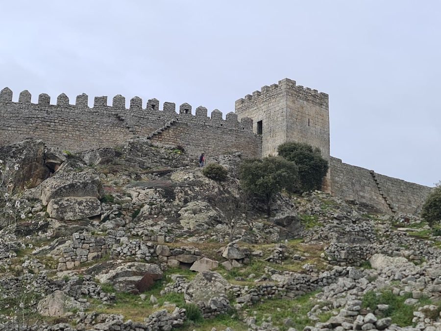
The ruins of the Castle of Carrazeda stand on a small granite plateau near the Serra da Vila mountains, overlooking arable lands and the valley of the Douro River. The fortification takes an irregular oval shape, encircled by thick walls constructed of granite blocks bonded with mortar. These walls reach up to 6.6 meters in height and are approximately 2.65 meters wide, providing robust defense for the settlement they once enclosed.
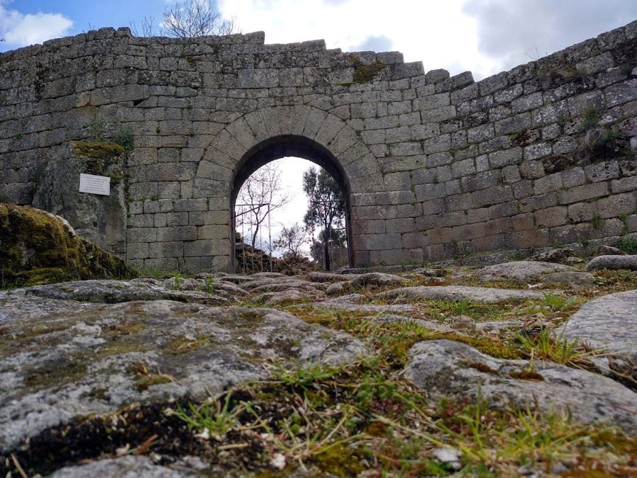
The defensive perimeter is reinforced by five rectangular towers, among them a square keep tower with two floors serving as the stronghold within the castle. The main entrance, located on the southern side, is called the São Salvador Gate. This gate features a Roman arch flanked by two rectangular towers, highlighting architectural influences from earlier periods. On the north side, near the keep tower, is a smaller entrance known as the Traitors’ Gate.
Within the castle walls lie the remains of vaulted granite cisterns used to store water. One of these cisterns has been obstructed, while another was dismantled and has not been reconstructed. Among the ruins are foundational stones of houses and small, cubical compartments that suggest organized urban living quarters. Parts of barbicans—defensive outworks attached to the walls—are also visible.
Surrounding the central courtyard is a second, larger defensive wall approximately 600 meters in length, strengthened by three rectangular towers. This outer enclosure defined the medieval town area, which included intersecting streets and several small neighborhoods. Along this enclosure, there are multiple gates with distinct names serving different access points: Fonte Vedra Gate to the south, Porta da Vila Gate to the east providing the main road to Lavandeira, and the São João and São Francisco Gates along the western side. These gates connect via stone-paved roads converging toward the town center.
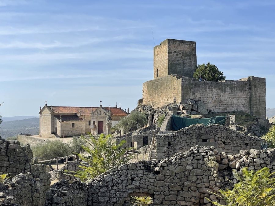
A small Romanesque church dedicated to São Salvador remains within the inner perimeter of the castle. Nearby, about 40 meters outside the castle walls, lie the ruins of a Roman-era convent dedicated to São João, indicating continuous religious presence in the area over centuries.
Additional features include the Fortim do Cubo, a square-shaped fortification, and the Torre dos Lameiros, a tower that has since been destroyed. Altogether, the site covers a vast area of roughly 9,594 hectares, encompassing not only the fortified medieval settlement but also the surrounding historic urban space.
No. 21381
No. 30021
No. 40104
No. 49464
Comments
Comments for Castle of Carrazeda will require a verified account before posting.
We'll send a verification link before your first comment is published.