No. 16852
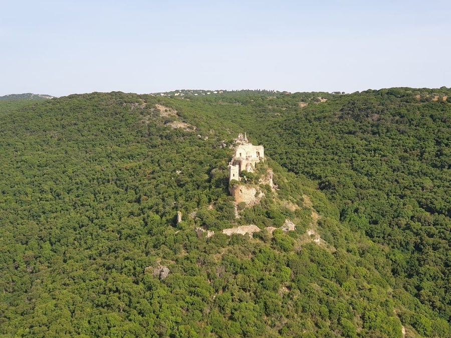
Montfort Castle
Israel
CastleRuin12th century

No. 87605
Château · Israel
No. 87605 · 32.705 N, 34.934 E
Quick summary
Château Pèlerin (Atlit) is a château in Israel with origins associated with the 13th century.
See all castles in IsraelChâteau Pèlerin stands on a rocky promontory at Atlit, Israel, and was built in the early thirteenth century by Crusader military orders, principally the Knights Templar with participation by the Teutonic Order. Construction began in 1218 under the initiative of King John of Brienne and the direction of a Flemish knight, Gauthier de Hauen. Builders first erected a smaller stronghold occupying roughly one third of the headland and later expanded the enclosure and defences as the settlement grew. Contemporary and later writers record discovery of springs during construction that supported the community.
The castle saw direct military action in the thirteenth century: Ayyubid forces under al‑Muʿaẓẓam besieged it in autumn 1220, and in 1265 the Mamluk sultan Baybars attacked, destroying the settlement outside the walls. After the fall of Acre on 28 May 1291 Château Pèlerin remained the last Crusader outpost in the region; evacuation of the garrison took place in early to mid August 1291, with final departure on the night of 14 August. Weeks later Muslim forces entered and deliberately demolished gates and towers.
Under Mamluk administration the town beneath the walls became an administrative centre and was at times resettled while the fortress was left unrepaired. In the fourteenth century an English account records relocated Oirat Mongols at the site. During Ottoman rule dressed stones from the castle were quarried for buildings in Acre, Haifa and elsewhere; stone removal continued through the nineteenth century and was compounded by earthquake damage in 1837 and later removals under Ibrahim Pasha and Ottoman governors.
Major archaeological work began in the twentieth century, including excavations by C. N. Johns around 1930–1934, underwater and shore investigations in the 1960s and 1970s, and harbour excavations by the Leon Recanati Institute at the University of Haifa in 2002. The ruins lie within the modern Atlit naval base and the site is inside a restricted military area.
The castle occupies a promontory that projects into the sea, defined by concentric defences and an outer perimeter that once enclosed a coastal civilian settlement. Builders reused large, well‑dressed ashlar blocks from earlier occupation and in places set foundations below sea level; masonry piers extend into the water to protect the walls from tunnelling and to support seaward structures.
A ditch crossed the narrow isthmus joining the promontory to the mainland, described in one account as a floodable trench roughly eighteen metres across and two metres deep that could be supplied from the sea, and in another as a stone‑lined cut excavated to about six metres depth. Ramps on the eastern side provided pedestrian and cart access into the defended tongue of land.
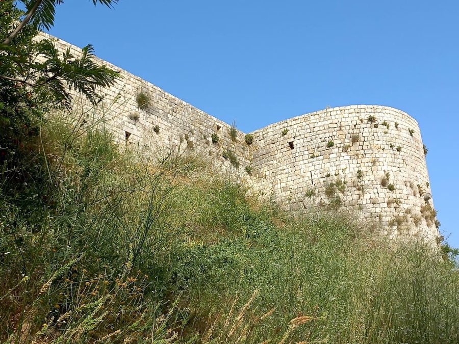
The outer seaward circuit survives in ruined but readable form. One description gives the wall a height of about fifteen to sixteen metres and a thickness of roughly six metres, with three projecting square towers spaced about forty‑four to forty‑six metres apart; the curtain originally held some forty firing loops in two levels. Parts of the seaward casing were taken below the tide line so that any attempt to mine under the wall would flood.
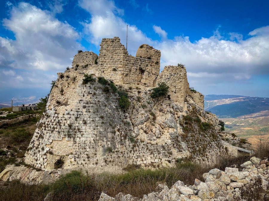
Behind the outer curtain a taller inner wall enclosed the citadel; one report gives the inner curtain a height near thirty metres and a thickness of about twelve metres. Two very large square towers anchor this line, with recorded heights ranging from about thirty‑four to forty‑three metres. A corridor linked these towers and allowed defenders on the inner walk to fire over the outer wall; internal galleries, staircases and vaulted chambers open off the inner enceinte.
The principal gateway lay on the southern approach between the two main curtains and led into a long flanked passage controlled by both walls, equipped with double‑winged doors and a wrought‑iron portcullis. A northern gate opened directly to the sea and served as the harbour entrance. Many wall faces show two distinct firing levels of slit‑loops for archers.
Within the inner enclosure stood domestic and religious buildings: a Gothic church with an east‑facing apse and three asymmetric apses, an ornate hall to the west of the church, service ranges along the western curtain including a kitchen and large refectory, storerooms and warehouses, and a southern courtyard giving access to a protected quay and boat landing.
Water supply features included three fresh wells inside the enclosure and references to springs discovered during construction. North of the castle on the beach a large Crusader cemetery has been recorded, measured at about eighty by one hundred metres with hundreds of graves; excavations have recovered roughly 1,700 gravestones. Architectural features recorded at the site include lofty vaulted halls with central columns and ribbed cross‑vaulting, an upper hall of about sixteen metres height, reinforced doors and raised grilles. Over centuries parts of the fabric were slighted after 1291, earthquake damage in 1837 reduced standing masonry, and extensive Ottoman stone‑robbery removed dressed blocks for reuse; Mamluk repairs and later modifications are also evident. Underwater archaeology has documented harbour structures that served the fortress.
No. 16852
No. 34531
No. 27984
No. 52216
Comments
Comments for Château Pèlerin (Atlit) will require a verified account before posting.
We'll send a verification link before your first comment is published.