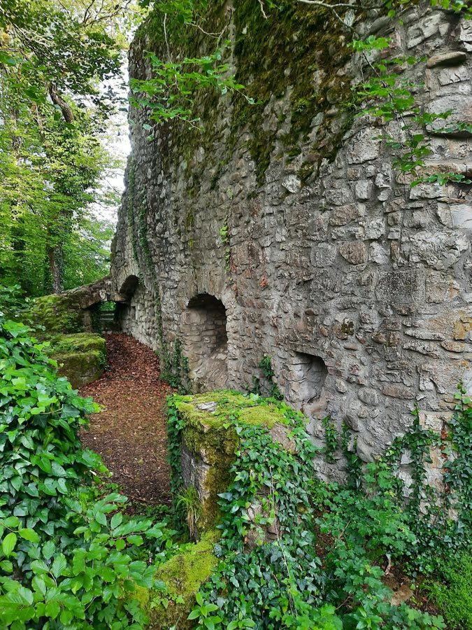
No. 66231
Weisswasserstelz
Germany
CastleRuin12th century
No. 13297
Castle · Germany
No. 13297 · 47.602 N, 8.354 E
For events
Küssaburg is marked as a château or castle venue lead. Capacity, indoor/outdoor spaces, catering rules, and accommodation options are published only after public verification.
Event types: Private events, Cultural gatherings, Filming and photography
Quick summary
Küssaburg is a castle in Germany with origins associated with the 12th century.
See all castles in GermanyKüssaburg is a hilltop castle in the municipality of Küssaberg, Germany, constructed by medieval German lords.
Archaeological finds and early hypotheses point to human use of the hill in Roman times, including the possibility of a Roman watch or signaling tower nearby, and the presence of a Gallo‑Roman sanctuary and a Roman country house in the surrounding area. A written reference to a castle on the hill appears in a monastery archive for the year 888, while other documentary evidence places construction of the medieval castle likely between about 1125 and 1141.
In the 12th century the site is linked with named individuals and local noble families. Heinricus de Chussaberch is recorded in the years 1135 and 1150. Werner von Küssenberg served as abbot of St. Blasien from 1170 to 1178. Over the following centuries the lordship passed through several hands: in 1241 Bishop Heinrich von Tanne of Constance is recorded as acquiring the lordship, around 1250 the counts of Lupfen appear as heirs, and later the counts of Sulz became holders, among them Rudolf V von Sulz. In 1703 the castle came by marriage into the possession of the princes of Schwarzenberg, and it remained in that family until the Klettgau region was acquired by the Grand Duchy of Baden in 1812.
Military action affected the castle on several occasions. During the Swiss War of 1499 the garrison surrendered on 20 April 1499, and the castle was later returned to the count of Sulz. During the 1525 peasant uprisings of the region, known as the peasants’ war, local peasant forces from the Klettgau besieged the fortress unsuccessfully, and Sulz forces carried out punitive measures. Following those events the castle was enlarged from 1529 with funds provided by Austrian authorities so it could serve more as a fortress with a standing garrison.
On 8 March 1634, in the chaos of the Thirty Years’ War, the castle was destroyed by fire. That destruction has often been reported as the garrison deliberately burning the complex when Swedish troops neared, while other contemporary evidence records operations by a detachment of a Swedish commander in the area and entries in period diaries. Later accounts record a landslide on 25 December 1664, though a geological assessment placed that event about two kilometres away from the ruin.
After the 1634 conflagration the castle remained a ruin and was used as a source of building stone by local people until the middle of the 19th century; legal measures ended removal of masonry in 1855. That same year provisional protection and access works began. Archaeological investigation began in the late 19th century with systematic excavations in 1896–1897, and a thorough clearance of the ruins was carried out between 1932 and 1939. Ownership of the site passed to the district authority Landkreis Waldshut in 1978, after which a sequence of conservation projects was carried out, with large expenditures during the first fifteen years following transfer. A restored gatehouse with a working wooden drawbridge was completed in 1981, the mechanism was adjusted in 1996, and the current drawbridge version dates from May 2017. A new conservation and sanitation plan was developed in 2018 with detailed works and funding foreseen. The south slope of the hill is designated as a nature reserve and the ruin is formally listed as a historic monument. The castle’s name was later used as the name of a steam locomotive on the Basel–Konstanz railway when that connection opened on 15 June 1863.
The castle sits on a flattened summit spur of White Jura rock that commands the pass route below, and its masonry reflects the local geology. Primary walling was constructed from the light-colored White Jura stone quarried on the hill, while many door and window surrounds, stair treads, lintels and other carved elements were cut from the brown sandstone of the nearby Wutach Formation. The plan reveals a compact summit stronghold set behind an outer bailey on a lower fore‑plateau, where service houses and habitations for dependents were once enclosed by a surrounding wall. Sections of that ring wall survive along the southern approach and give the forecourt a defined footprint on the slope.
Visitors can still make out the sequence of approaches into the core. An outer gate and a secondary inner gate controlled entrance into the summit court. The gatehouse has been reconstructed and today carries a functioning wooden drawbridge that was rebuilt in 1981, mechanically rebalanced in 1996 and replaced in its present form in May 2017. That reconstructed bridge uses a counterweight arrangement so its movement is self‑regulating beyond a certain angle. During 20th‑century works a temporary wooden bridge built by a technical relief organisation was also placed spanning the moat.
Within the inner enclosure a residential hall with an observation platform occupies one side of the court. A tower immediately left of the entrance contains the remains of what served as a dungeon, while another tower housed a ground‑level storage room. A rounded defensive projection stands in front of the left tower, forming an outward bulwark. A cistern for collecting water lies before the storage chamber, and the surviving masonry of a chapel stands adjacent to that cistern, offering evidence of the castle’s religious provision for its inhabitants. Around the courtyard the foundations and lower walls of several multi‑storey domestic and service buildings remain visible, showing the once‑dense arrangement of household space.
Traces of the castle’s violent end are visible in the stonework. Interior facing stones show a wine‑red discoloration that is interpreted as evidence of the 1634 burning. Masonry also incorporates two wheel‑grooved stones taken from the old Roman road that ran below the hill; those reused road stones derive from a steep Roman road segment that remained in use until 1871. In the economic area to the right of the entrance two console stones carved with small grotesque figures survive as ornamental fragments.
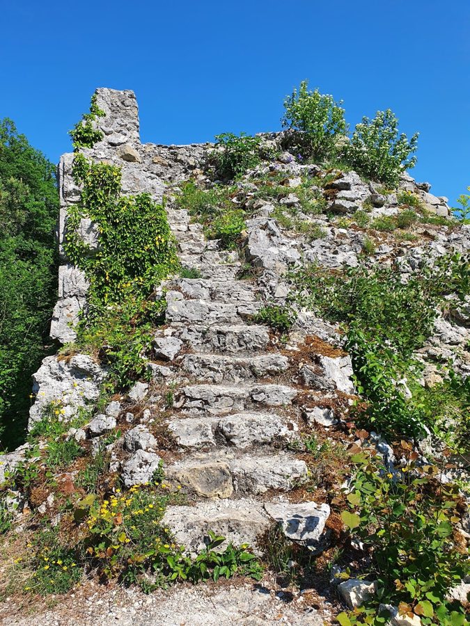
Heraldic and sculptural elements have a mixed history on site. Around 1800 a double alliance coat of arms was reported, and an original carved heraldic stone was recorded as stolen about 1847. The coat of arms now displayed above the restored gate is a modern composition carved in 1983 after a contemporary outline; it is not an original medieval relief. The ruin generally survives as a conserved but fragmentary monument, with standing wall sections, tower remnants such as a surviving southwest corner tower fragment, and a visible ground plan laid out on the summit; parts of the complex have been stabilized and in places rebuilt following the clearances and conservation campaigns of the late 19th and early to mid 20th centuries.
No. 66231
No. 55108
No. 50205
No. 66762
Comments
Comments for Küssaburg will require a verified account before posting.
We'll send a verification link before your first comment is published.