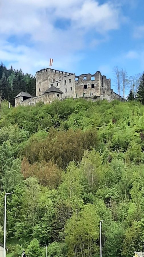
No. 80503
Burgruine Lichtenegg
Austria
CastleRuin14th century
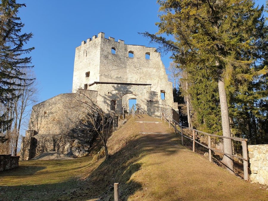
No. 51850
Castle · Austria
No. 51850 · 47.555 N, 15.621 E
For events
Ruine Hohenwang is marked as a château or castle venue lead. Capacity, indoor/outdoor spaces, catering rules, and accommodation options are published only after public verification.
Event types: Private events, Cultural gatherings, Filming and photography
Quick summary
Ruine Hohenwang is a castle in Austria with origins associated with the 12th century.
See all castles in AustriaRuine Hohenwang, situated in the municipality of Langenwang in modern Austria, was established during the 12th century by members of the noble Stubenberger lineage. Its foundation likely occurred between 1122 and 1160 under the initiative of Erchinger I. von Landesere, who belonged to this influential family. From its inception, the castle functioned as a local administrative center in the upper Mürztal region.
First recorded in 1222, Hohenwang was initially held by the Landesere family until their extinction in 1286. Afterward, ownership passed among several noble houses, including the Stadecker, Fladnitzer, and Montfort families. From 1512 onward, the Scherffenberg family became the principal lords of the castle and retained control into the 17th century. Historical accounts suggest they treated the local peasantry relatively kindly during their tenure.
Throughout its history, Hohenwang played a role beyond administration. It hosted a resident priest from the 13th century, and its chapel, dedicated to the Visitation of Mary, became a local pilgrimage destination. Between around 1580 and 1600, amidst religious tensions, the chapel was used between Protestants, reflecting the Scherffenberg family’s involvement in these conflicts.
The castle was subject to several military episodes. It was occupied by Hungarian mercenaries during King Matthias Corvinus’s 1477 incursion into the region. Later, in response to fears of Turkish raids during the 16th and 17th centuries, defensive measures including a nearby fire beacon post equipped with artillery were established to provide early warning and protection.
Hohenwang endured multiple destructive events. A major fire in 1525 caused substantial damage. In 1700, lightning struck its chapel tower, impairing the structure. An earthquake in 1770 further compromised the site, and during World War II in 1945, bombing destroyed parts of the southern curtain wall as well as what remained of the chapel.
By the early 18th century, the castle’s upkeep dwindled. To evade taxation, the roof was removed, and administrative operations shifted to Schloss Neu-Hohenwang, a more comfortable residence in the valley, completed by 1780. The final inhabitant known was a hermit, who reportedly died from a lightning strike in 1774.
Since 1961, a dedicated association named Burgverein Hohenwang has undertaken conservation efforts. Their work includes stabilizing walls, restoring gates, and making the castle grounds accessible, supported by exhibits such as a scale model depicting its 16th-century appearance.
Ruine Hohenwang occupies a narrow hilltop site stretching approximately 90 meters from southwest to northeast without a central tower or keep, which is notable for its time. The complex consists chiefly of a main stronghold (Hochburg) and a front castle (Vorburg) set before it, separated by trenches and encircled by a curtain wall.
The main stronghold, predominantly dating from the 12th century, features a robust Romanesque core. Its shield wall rises more than 20 meters high and is about 2 meters thick, designed to withstand siege engines. The wall is topped by rectangular battlements and contains three substantial window openings, providing both defense and light. This core housed the primary residential building, or Palas, extending roughly 34 meters along the northern wall and enclosing a large courtyard around 65 meters long. Archaeological indications include preserved ochre stripes painted on a white background in one portion, hinting at decorative wall paintings.
In front of the main castle, a lower section completed in the 17th century stretches about 60 meters and includes an irregularly shaped bastion known as the Hochgarten on the south side. This bastion sits partly on artificial ground and displays a rounded corner facing southeast. West of this bastion once stood a stable building, although today only minimal remains survive.
The castle’s defenses comprised three fortified gates, two with sally ports allowing defenders to sortie out. The main gate dates from the 16th to 17th centuries and remains the best-preserved ruin. It consists of a gate chamber featuring a manhole and once had two keyhole-shaped gunports for muskets or small artillery, with one of these still intact. Historical depictions reveal that the gate tower was originally crowned by a distinctive onion-shaped roof.
On the southeastern side of the main stronghold, a double-angled defensive gallery, called a Wehrgalerie, protected the shield wall. Only its southeast wall survives, pierced with three firing slits embedded in deep recesses and a sally port for counterattacks. Access to this gallery came through a flat-arched gate formerly spanned by a drawbridge over a deep, four-meter-wide fissure in the rock. This drawbridge was later substituted with a fixed wooden bridge.
Instead of a traditional keep, natural defenses bolstered the castle’s security: steep cliffs protected its southern, western, and northern flanks, while a wide neck ditch up to 25 meters across allowed controlled access from the east. This ditch originally was crossed by two drawbridges and once had a stone arch bridge, now replaced by a masonry causeway.
A 15th-century inventory offers insight into the castle’s interior arrangement, listing a chapel, servants’ quarters, a great hall, four cellars, four granaries, a bathhouse, kitchen, and vaulted stables capable of housing twelve horses.
The castle’s chapel, dedicated to the Visitation of Mary and built in the 12th century, showcased typical Romanesque features including a polygonal choir with a five-eighths semicircular closure and capitals bearing double-leaf designs. Two finely crafted Romanesque round-arched windows illuminated the interior. The chapel had a bell tower which was destroyed by the 1700 fire. Due to structural concerns, the chapel was demolished in 1776, with its important late Gothic altarpiece from 1509 and a venerated image relocated to the nearby parish church and a newly constructed Marian chapel.
Water was supplied by a draw well approximately 45 meters deep, equipped with a large wooden tread wheel measuring four meters in diameter. This device allowed the lifting of around 100 liters of water per ten minutes of operation. Supplementing the well, a wooden pipe system around 4 to 5 kilometers long carried spring water from near Brunnsteig/Wetterkreuz, with iron fittings for the pipes discovered during excavations in the 20th century.
Defensive structures also included a frontwork with a crenellated gatehouse resting on two supporting arches. This gatehouse featured battlements and arrow slits and once housed a smithy in the 15th century; this building no longer survives.
Adjacent to the castle lies a flat meadow known historically as “Der Platz am Sprengzaun,” which was used for tournaments and festivals, complemented by a nearby riding training ground close to Siglreit/Timmerteich. Since the 1960s, restoration projects have reinforced and partially reconstructed key walls, gates, and the shield wall, preserving the ruins and integrating them into a maintained park-like environment.
No. 80503
No. 74680
No. 24000
No. 88132
Comments
Comments for Ruine Hohenwang will require a verified account before posting.
We'll send a verification link before your first comment is published.