No. 43943
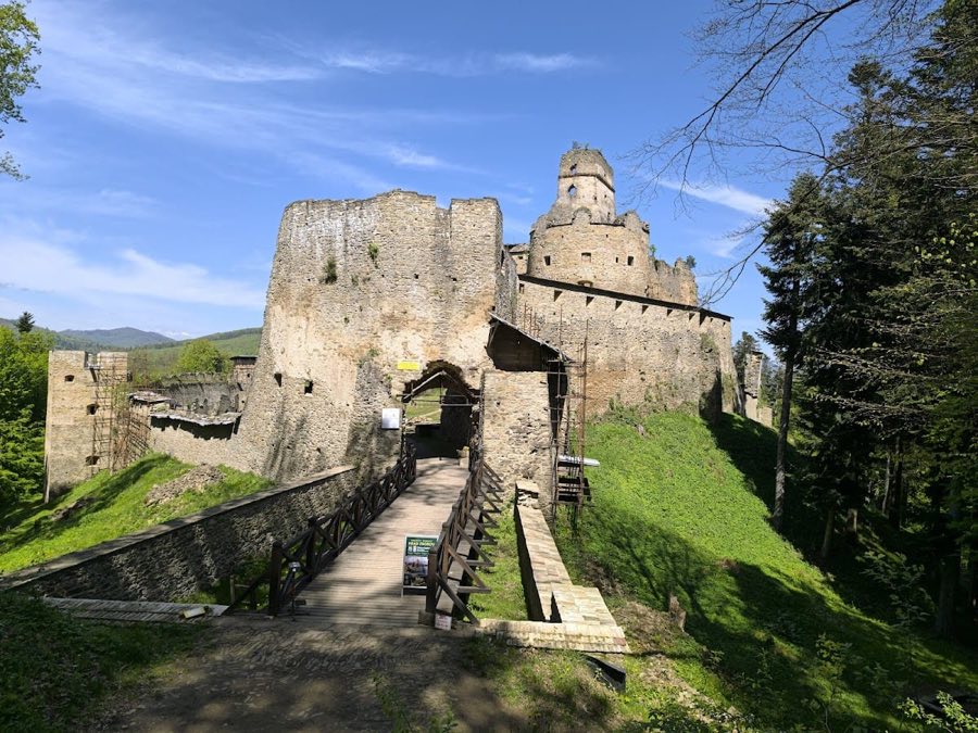
Zborov Castle
Slovakia
CastleRuin14th century
No. 69217
Castle · Poland
No. 69217 · 49.778 N, 21.441 E
Quick summary
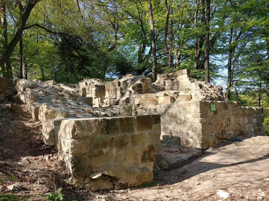
Zamek Golesz in Krajowice is a castle in Poland with origins associated with the 14th century.
See all castles in PolandZamek Golesz w Krajowicach is located near the village of Krajowice in southern Poland. It was established by the medieval Polish civilization as a fortified site associated with the Benedictine Abbey of Tyniec, serving both defensive and administrative functions.
The origins of Golesz date back to the 13th and 14th centuries when it began as a gord, a type of wooden, fortified settlement common in medieval Poland. Early records from the early 14th century describe disputes involving Jakub Bogoria and the Tyniec abbot regarding ownership and control of the site. Royal decisions made in 1319 and 1320 affirmed the Benedictines’ ownership while permitting Bogoria to temporarily manage the fortification on condition that he repair or replace the existing wooden structures. This likely led to the construction of the first stone castle after 1420, transforming the site from a simple wooden encampment into a more permanent stronghold.
Throughout its history, Golesz served as an administrative center where the starosta, a royal official, governed the abbey’s estates across the Wisłoka and Biała river basins. It functioned as a manorial court known in Polish as a sąd leński, where legal and economic matters were handled. The castle also guarded an important river crossing along a trade route linking Poland to Hungary and acted as a rallying point for local military levies during times of conflict.
In the 1330s, the castle experienced military action when it was occupied by Iwan of Klecia, reflecting the turbulent nature of regional power struggles. Later, in 1474, Hungarian forces mounted an attack that inflicted significant damage on the fortress. The Benedictine abbot Andrzej Ozga led a reconstruction effort between 1477 and 1487, restoring the castle’s defenses and buildings.
Following this rebuilding, Golesz continued as the seat of the royal starosta and became the site of the highest court established under Magdeburg law for the surrounding area. This legal status enhanced its regional importance well into the early modern period.
The castle’s use declined after the early 17th century, and in 1657, it was destroyed by Transylvanian troops under George II Rákóczi during military campaigns in the region. Some historians propose that later Swedish invasions, especially in 1664, may have contributed to the site’s final destruction. Subsequently, the Benedictines retained ownership until the dissolution of the abbey under Austrian rule in the late 18th or early 19th century.
By the 19th century, the castle had fallen into complete ruin. Its grounds were transformed into a recreational park under the care of Achilles Johannot, marking a shift from military and administrative use to leisure and cultural appreciation. Archaeological interest in the site grew over the 19th and 20th centuries, revealing layers of its complex history through excavations and documentation.
Zamek Golesz is situated atop a pointed oval hill measuring approximately 47 by 30 meters and rising more than 100 meters above the Wisłoka valley floor. The site’s elevated position and natural sandstone outcrops provided a strong defensive advantage. Surrounding the hilltop, an earthen rampart up to three meters high remains visible today, outlining the boundaries of the castle’s defensive perimeter.
The castle’s layout forms an irregular triangular polygon. At its northern tip stands a round tower, known as a baszta, which is one of the most significant surviving structures. This free-standing tower, perched on a small rise just north of the main enclosure, likely represents the site’s earliest stone construction, dating to the early 14th century. It measures 10.5 meters in diameter, with exceptionally thick walls about four meters wide, indicating a robust defensive role during the castle’s earliest stone phase. This tower remained in use until the late 15th century.
Within the castle’s main courtyard, a smaller northern round tower is found at the apex of the triangular layout. It has an external diameter of six meters and an internal space about two meters wide. Its upper sections consist of large, regularly shaped stones placed in lime and sand mortar, while the base includes smaller and broken stones. This tower dates broadly from the late 15th to early 16th century, likely constructed during the post-1474 rebuilding overseen by Abbot Andrzej Ozga.
The curtain walls enclosing the castle vary from 1.5 to 2 meters in thickness and are built primarily of broken sandstone blocks and stones, held together with lime or lime-sand mortar. Excavations uncovered seven segments of these walls. A notable feature along the southern wall is a protruding bastion constructed of carefully selected large stones on lime mortar, measuring roughly 1.8 meters wide. This bastion would have strengthened that section of the fortification. Archival records from the 19th century mention a second round tower in the southeast corner, though today it has likely collapsed into a ravine.
The gatehouse stands on the side opposite the northern tower and measures approximately 12 by 10 meters. It features a passage about 2.5 meters wide, constructed of large, square stone blocks that differ in form and finish from the curtain walls. The gatehouse incorporated two side chambers, which served as guard rooms. These chambers are documented in historical archives and were confirmed through archaeological sondages carried out in 2016. The gatehouse dates to around the 16th century, reflecting later adaptations to the castle’s defenses.
Inside the northern courtyard, archaeologists uncovered the remains of a residential building roughly 8.5 by 4.5 meters in size that showed signs of having burned down. Traces of daub—a type of mud plaster—and blackened burn marks on stones suggest fire damage confined to this structure, with no evidence of spread to surrounding areas. The building lacked enclosing walls, and the presence of a thin wooden partition was inferred from impressions along one side.
Alongside the ruins of the burned building, a corner section of a probable wooden construction abutting the curtain wall was identified. This feature consisted of three layers of stones with small pebbles and appeared to be a later addition to the castle complex, perhaps representing a subordinate structure or outbuilding.
No paved or artificially hardened surfaces were discovered within the courtyard, implying that open areas remained largely natural or covered with dirt.
Near the entrance to the castle, a natural rock outcrop features carved steps that served defensive and access purposes in earlier phases. These steps exemplify how the builders integrated natural formations into the fortifications.
Overall, the castle’s ruins lie within the protected Golesz Nature Reserve, part of the broader Natura 2000 network aimed at preserving the region’s sandstone formations and rare plant life. Excavations at the site have unearthed medieval and early modern ceramics, fragments of weaponry, and Gothic-Renaissance stove tiles, which together trace the site’s history of prolonged occupation, military significance, and periods of rebuilding. Since 2015, conservation efforts have focused on stabilizing and partially reconstructing the gatehouse and northern tower, enabling visitors and scholars to better appreciate the castle’s architectural and historical legacy.
No. 43943
No. 15366
No. 99662
No. 74150
Comments
Comments for Zamek Golesz in Krajowice will require a verified account before posting.
We'll send a verification link before your first comment is published.