No. 66458
Burg Warberg
Germany
CastleRestored13th century
No. 28171
No. 28171 · 52.352 N, 10.709 E
For events
Burg Campen is marked as a château or castle venue lead. Capacity, indoor/outdoor spaces, catering rules, and accommodation options are published only after public verification.
Event types: Private events, Cultural gatherings, Filming and photography
Quick summary
Burg Campen is a palace in Germany with origins associated with the 13th century.
See all castles in GermanyBurg Campen stands in the municipality of Lehre, Germany, and was established under the authority of the medieval Welfian territorial rulers.
The site existed before its first written mention in 1279 and was already regarded as a late-13th-century lowland castle built to guard the Braunschweig–Altmark trading route. In 1279 the castle was captured during a conflict between Duke Heinrich, known as “the Admirable,” and Duke Albrecht, called “the Fat,” on one side and Bishop Otto I of Hildesheim on the other. Seventy vassals of the bishop were taken prisoner during that action. Medieval records show the Welfian ministerial family von Blankenburg were enfeoffed with the place and subsequently adopted the castle’s name; in 1326 the knight Jordan von Campe formally gave up his claims there.
Throughout the later Middle Ages and into the early modern period the property passed repeatedly between holders, sometimes by pledge, and was held at various times by the dukes of Braunschweig, the von Saldern and von Knesebeck families, and the city of Braunschweig, with ownership transactions recorded up to 1512. Between 1585 and 1596 Duke Wilhelm the Younger of Braunschweig-Lüneburg transformed the stronghold into a five-winged schloss. Contemporary descriptions and depictions of that rebuilding record a gatehouse, stables, a cavalier house, a prison and a pleasure garden as components of the enlarged complex.
By 1706 the estate was part of the Principality of Braunschweig-Wolfenbüttel and functioned as a princely administrative house. Over the 18th and 19th centuries the former castle site lay beneath a postal road between Braunschweig and Calvörde. The bulk of the castle’s buildings had already been pulled down by the late 1700s, and the estate later became known as the Campen domain. The municipality of Flechtorf acquired the property in 1860, afforested parts of it and let it in small holdings, and an innkeeper purchased the remaining complex in 1881.
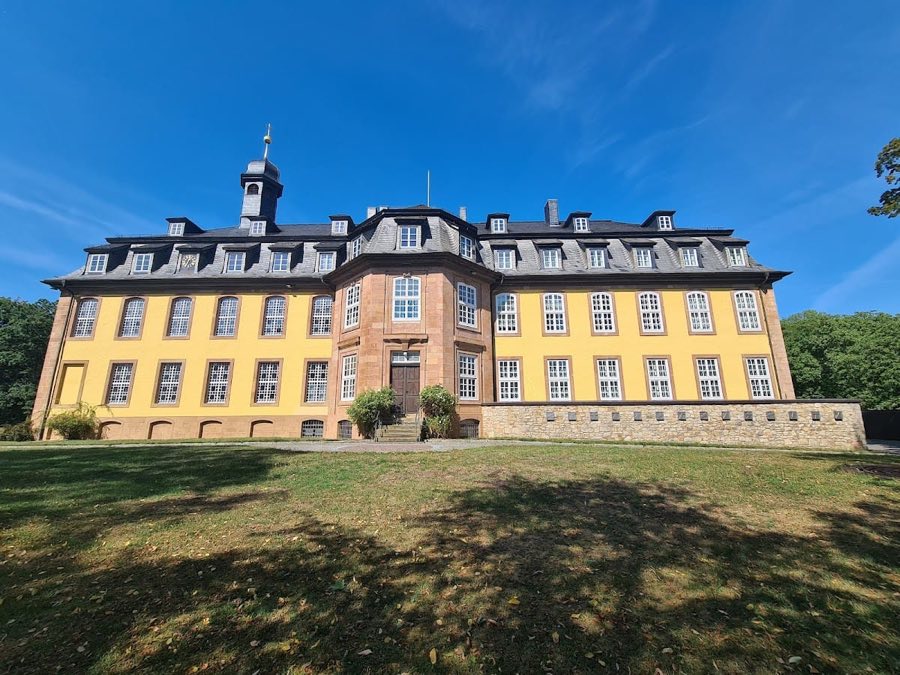
In the 20th century the two-storey main building survived. On 1 April 1932 the Hitler Youth, following an initiative by NSDAP regional leader Hartmann Lauterbacher, leased the main house as a regional leadership school named for Albert Leo Schlageter. Courses for up to forty participants ran from May 1932 until funding problems closed the school on 8 January 1933. After 1933 the site was used intermittently for Hitler Youth training, conferences and a junior leadership school under Bannführer Erich Steinacker, and the National Socialist party acquired the property in 1937. Following the Second World War ownership passed to the state of Lower Saxony. In 1970 the local municipality declined to assume responsibility because of renovation costs estimated at about 500,000 Deutsche Mark. The property is presently privately owned and used as a residence. Archaeological fieldwork in 1997, 2000 and 2001 accompanied these documentary traces, clarifying aspects of the site’s military and domestic past.
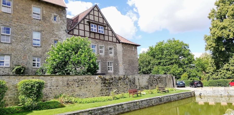
The castle occupies a slightly raised plateau south of Flechtorf’s historic centre within the Schunter river floodplain, sitting between two river channels and beside a small canal that once fed a mill. The plateau measures roughly eighty by one hundred metres. Late 18th-century plans show the core of the site as an irregular hexagon, with the administrative house on the north side and polygonal half-timbered wings set against a Renaissance-style ring wall.
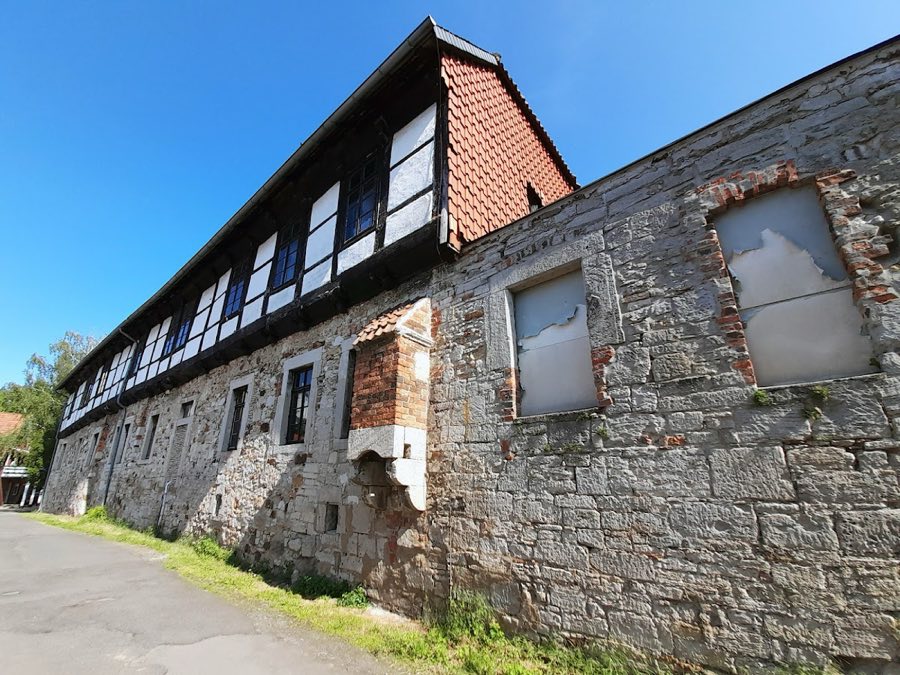
Surviving masonry includes part of the late 16th-century princely administrative house, which retains a stone ground floor with a timber-framed upper level attached. A high freestanding wall section, linked to the office building’s walls, displays several round-arched windows and stands as a conspicuous fragment of the later schloss. The northern enclosure preserves an external latrine projection, recorded historically as part of the complex.
To the south the plateau is closed by the remains of a former moat that is now dry; the area that has been used as a garden is bounded by this southern moat remnant. Beyond the inner enclosure the former lower ward occupied a forework or outer bailey that was itself surrounded by a water-filled moat in earlier phases. Medieval stonework was reused in later construction and can be seen incorporated into a modern structure known locally as the “Atelier.”
Archaeological investigations recovered a medieval farmstead near the castle in 2000, found beneath a substantial burn layer and containing weapon fragments including crossbow bolts; this assemblage has been linked to the documented attack on the site in 1279. Fieldwork in 1997 and 2001 identified a feature referred to as the “Pallwall.” A 1740 map shows four siegeworks connected with the 1279 siege; those earthworks are no longer visible on the ground, and a nearby quadrangular feature, measuring about forty by forty metres and lying roughly three hundred metres from the castle, was shown by excavation to be a modern planting garden. Today only a handful of structural elements on the plateau attest to the castle’s long sequence of medieval and early modern phases.
No. 66458
No. 91456
No. 18741
No. 24160
Comments
Comments for Burg Campen will require a verified account before posting.
We'll send a verification link before your first comment is published.