No. 70607
Piber Castle
Austria
CastleRestored11th century
No. 24357
Castle · Austria
No. 24357 · 47.106 N, 14.961 E
Quick summary
Burg Klingenstein is a castle in Austria with origins associated with the 16th century.
See all castles in AustriaBurg Klingenstein stands in the municipality of Maria Lankowitz, Austria; it was erected in the Late Middle Ages, probably in the late 1400s, and may have been built by the Counts of Montfort. The castle was placed to guard a mountain trade route that ran from Voitsberg over the Gaberl into the upper Murtal, a strategic position on a narrow ridge above the surrounding valleys.
The main castle appears to have been raised in a single building phase during the late 1400s. Documentary and structural evidence place active occupation in the 1500s. Archaeological layers of thick charcoal and heat-damaged stone, together with written observations, record that the complex was likely destroyed by fire in the 1500s and thereafter was not rebuilt for continued habitation. Finds that can be dated do not extend beyond the 1500s.
By the middle of the 1500s the site belonged to the noble Saurau family, with Gilg von Saurau recorded in 1550 and references to Saurau ownership continuing into 1618. Ownership later passed by marriage into the Glojach family and, in 1629, the property was sold to Benigna, the wife of Veit Sigmund von Herberstein. In 1650 the lands and adjacent woods were transferred to Leonore Eusebia, Countess Wagensperg, and were incorporated into her Herrschaft called Greißenegg. An 1787 map already labels the ruin as an old castle, and the name Klingenstein is attested in written records by 1834; the site has also been known locally as Burg Salla and is sometimes cited with both names.
In the 1800s the ruin passed into the hands of a family of stonemasons named Grein. During the 1900s ownership changed to the Petrasch family, with Arne Petrasch identified in later reports. Small archaeological investigations were carried out in 1993, 1994 and 2000, conducted in part by volunteers and covering only portions of the site. From 1982 or 1983 a local mayor, Hubert Stiefmann, supervised securing and rebuilding work that continued for about twenty-five years; some of these reconstruction measures involved new building and were subject to debate among castle specialists. In the summer of 2013 an electricity line was run to the ruin to provide night illumination.
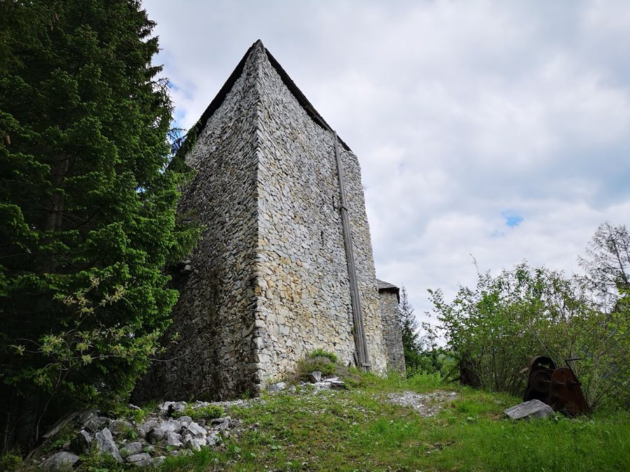
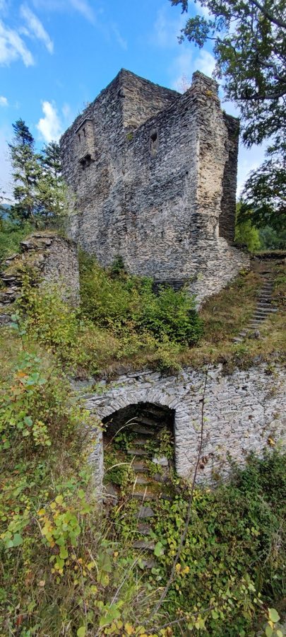
The castle occupies the end of a narrow wooded ridge and is built largely of locally quarried marble set as irregular rubble masonry, with larger blocks and a few squared facing stones used in the lowest courses. The site consists of a core castle at the ridge tip and an outwork that extends roughly one hundred meters along the western ridge. A rock-cut defensive ditch once cut across the ridge to protect the westward approach; parts of that ditch survive alongside later access changes.
The outwork contains the foundations of at least three separate buildings or towers. The westernmost of these has a fan-shaped plan that faces southwest; its interior runs about 6.5 meters, the curved outer wall rises more than a meter above recent ground level and reaches roughly four meters in width. That wall is one of the only rounded masonry sections on the hill and measures about one to one and a half meters thick. Inside a projecting masonry tongue divides the space into two small chambers each under two meters across, with stone slab thresholds at the entrances. Parts of the east and north walls of this building collapsed and were partly rebuilt during work in the 1900s.
Further east along the outwork ridge stand isolated wall fragments and scattered rubble heaps that mark former connecting walls. About forty to sixty meters north of the western building an isolated corner preserves a more irregular form of quarry-stone work. The middle outwork survives as a corner with lengths of about 4.5 by 1.75 meters and wall thickness near 0.8 meters; if that corner occupied the expected footprint, the structure would have measured close to six by three meters. The eastern outwork building is nearly square, with external sides measuring about 7.6 by 7.5 meters and walls mostly around one meter thick, increasing to roughly 1.4 meters where it abuts steep terrain. A short wall running northeast from its eastern face appears to have served as a defensive return.
A neck ditch once linked the outwork to the core castle, and traces of that ditch survive north and south of the later access route where it was partly filled. North of the core castle a line of walls runs along a cliff edge to form an almost trapezoidal enclosure; those wall remains stand up to about two meters in height and the western portion of that line is missing, with no clear structural tie recorded between that cliff-edge wall and the core buildings.
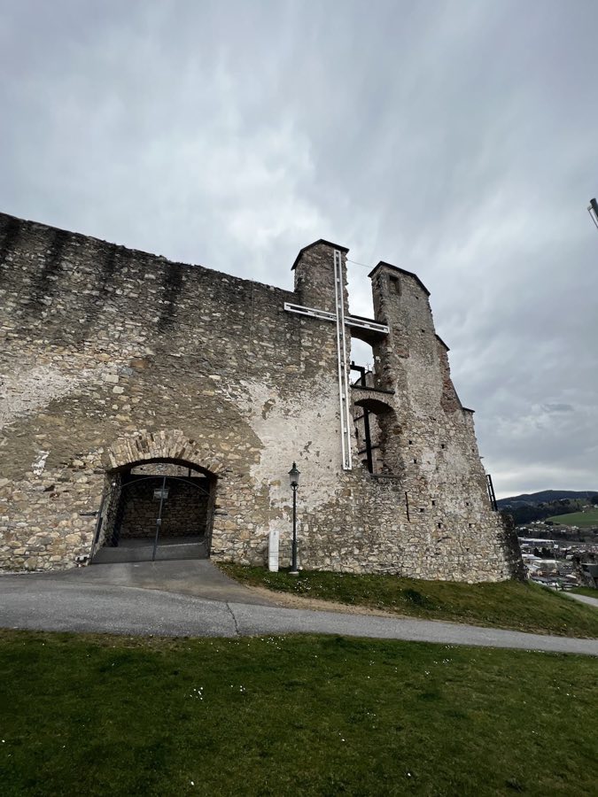
The core castle was erected in a single building phase in the late 1400s and consists of an irregular triangular keep at the ridge tip with an attached east building complex. Most of the visible above-ground masonry was rebuilt during repairs undertaken after 1982. The keep has a sharp western ridge edge and outer side lengths measuring about 9.8, 11.9 and 12.7 meters. Wall thicknesses vary, from around 2.2 meters on the southwest face to roughly 1.7–2.1 meters on the northwest face, with a reinforced eastern lower section that tapers upward. The north face preserves three original window openings plus a recess that suggests a possible fourth, features that indicate the tower had at least three, probably four, upper floors. The original entrance likely stood at second-floor level, reached from the adjacent east building.
Inside, the keep’s triangular ground plan becomes irregularly five-sided because of an internal masonry projection about 1.8 to 2.0 meters high. Vertical light slits appear in the lower northwest and southwest walls, and the southwest slit was added during later repairs. Remains of plaster survive on the lower eastern wall and multiple square beam-holes mark positions for intermediate floors. Small recessed niches appear in the northern and western corners; one western niche is finished with slab lining.
Excavations uncovered fragments of fired tiles and clay associated with a tiled stove, stylistically dated to the late 1400s and linked to a workshop in Buda, which indicates the keep contained at least a modest tiled heating stove. The east building complex attaches directly to the keep and stretches about eighteen meters in length, narrowing and widening at points to roughly eight to ten meters across. Wall thicknesses there are generally about 1.3 to 1.4 meters. The north wall directly east of the tower preserves three vertically aligned window openings and traces of a fourth, while another possible original window lies farther east. Five defensive openings puncture that north wall at intervals of about two and a half meters.
A southeast flanking tower stands at the east end of the complex and is nearly square, with outer sides of roughly five to six meters. Its southern and western walls measure about 1.3 to 1.4 meters thick, the eastern wall about 1.2 meters and the north wall facing the interior about 0.9 meters. Four ground-floor defensive openings survive in that tower, two looking east, one south and one west, with the more northerly eastern opening set higher than the others.
Many of the defensive openings are firearm-style embrasures, each with an external vertical slit about 0.5 to 0.6 meters long and near 0.1 meter wide that terminates in a slightly lowered, widened base roughly 0.2 to 0.3 meters deep. Inside those openings the masonry widens and a flat stone top slab is present. Several embrasures retain holes used to receive a horizontal timber beam, known in some accounts as a Prellholz, which would have been fitted across the inner face. Two openings on the east-north section of the north wall are instead built as simple narrow slits.
The southern wall east of the keep contains a rounded arched portal about 2.7 meters wide; that portal has been described as a modern intervention which may reflect the original entrance position. The portal’s side walls contain two vertically stacked cavities, each some 0.6 to 0.9 meters deep and about 20 centimeters across, interpreted as sockets for sliding beams or gate fittings. From the portal a small square opening about 25 centimeters across and roughly 2.1 meters deep leads into the keep masonry. The terrain immediately outside the portal was originally steep and rocky but was leveled in the 1900s to create easier access.
No. 70607
No. 35781
No. 42191
No. 47909
Comments
Comments for Burg Klingenstein will require a verified account before posting.
We'll send a verification link before your first comment is published.