No. 82772
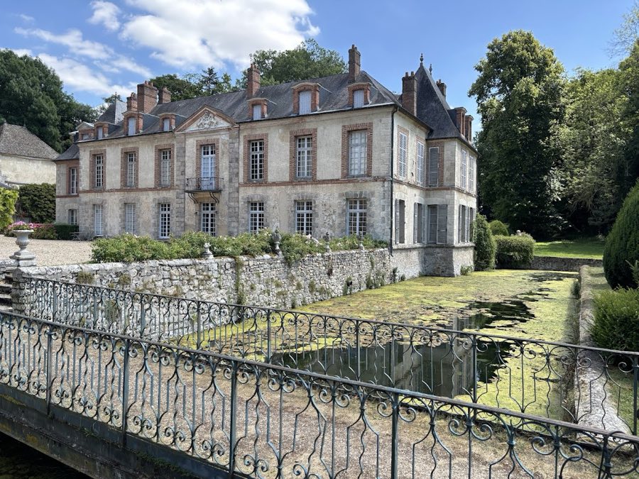
Château du Saussay
France
ChâteauRestored18th century
No. 87919
Château · France
No. 87919 · 48.437 N, 2.158 E
Quick summary
Château d'Étampes is a château in France with origins associated with the 12th century.
See all castles in FranceChâteau d’Étampes, Walberberg, France, was erected by the medieval French monarchy.
A first stronghold at Étampes dates to the reign of King Robert II. In the 12th century, at the request of King Louis VII, the present stone keep was raised, replacing earlier timber or earthwork defenses. Before the end of that century, King Philip II ordered a square outer wall built around the keep, and later a second wall was added beyond it.
From 1201 to 1213 the keep served as the place of confinement for Queen Ingeborg. On 16 January 1358 English forces took the town and castle, and they were restored to French control immediately afterwards by Charles V. On 28 January 1387 Jean de Berry is reported to have handed the castle to his brother Philippe the Bold. On 15 December 1411 Jean sans Peur besieged town and fortress, and the place was annexed to the duchy of Burgundy. Around 1416 the castle was used as a model for the richly illuminated manuscript Les Très Riches Heures of the Duke of Berry.
Following the battle of Montlhéry, Charles the Bold occupied the castle from 19 to 31 July 1465. In the early 16th century, Anne of Brittany lodged at the castle in 1513 and Claude of France stayed there in 1516. During the Wars of Religion the prince de Condé seized the fortress between 13 December 1562 and 2 January 1563, and it was retaken on 2 January 1563. In 1589 King Henri IV permitted the townspeople to dismantle the castle to reclaim its building stone; after that operation only the keep remained standing.
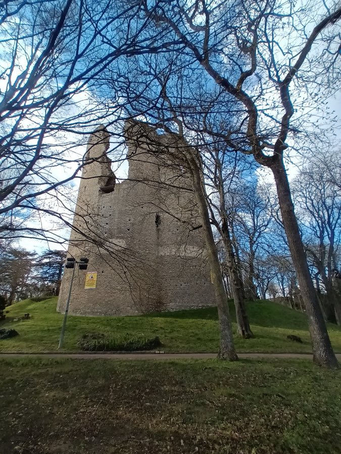
The surviving tower again saw hostile action on 4 May 1652. During the French Revolution the parcel containing the tower was sold as national property, the purchaser demolished the remaining buildings and used the tower as an open-air stone quarry, and the site lay abandoned until the Restoration. In 1821 Louis-Philippe, Duke of Orléans, sold what remained of the castle. The town acquired the keep’s ruins in 1859 to create a public promenade, and the keep, known as the Tour de Guinette, was entered on the national list of historic monuments in 1862. In recent times the town council has opened a call for donations to repair the tower, citing damage from pollution and from pigeons.
The surviving monument centers on a massive stone keep set on a raised platform, surrounded in succession by three concentric defensive enclosures that formed a compact royal fortress. The keep has a four‑lobed cloverleaf plan with a central well. Recorded measurements of the keep vary, with an overall diameter given near 72 meters, each lobe about seven meters across and a height around 36 meters in some accounts, while another description gives a height near 27 meters. A deep well was sunk at the tower’s core and the keep occupies the platform that once stood at the heart of the inner enclosure.
The inner square enclosure directly around the keep measured about 54 meters to a side and was protected by towers at its corners; a south‑east gateway with a drawbridge provided controlled access from the platform. Beyond this lay the first bailey, itself closed by a second square wall recorded at roughly 90 meters per side, where a second well was dug on the western side. Attached to this second curtain wall were a large chapel dedicated to Saint Laurent on the north‑east, measuring some 36 by 18 meters, and a residential building on the south‑west. Within that bailey three lodging ranges occupied the west side; on the east a covered gallery ran along the wall to overlook the town below; four bread storerooms stood at the north‑west.
A third, outer enclosure of roughly hexagonal to near‑quadrangular form enclosed the second bailey. Wall lengths recorded include about 160 meters on the north‑west face, 180 meters on the north face, and 140 meters on the south‑east face. The south side of that outer circuit was strengthened by a large rectangular gun platform or battery about 54 by 36 meters, defended by three towers. Two main external gates with drawbridges faced north: the gate toward Étampes on the north‑east and the gate toward Dourdan on the north‑west; these outer entrances were separated from the inner bailey by two further internal defensive gates and they were linked by a central ceremonial court. Corner towers and a surrounding ditch completed the defensive system.
Entry to the keep itself required passing a small south‑facing postern that opened into a vestibule and then into a defensive pit roughly four meters deep, reached by a stair built into the wall. The tower’s internal arrangement begins with a vaulted cellar about ten meters across containing the central well and latrines; the vault and the five‑metre‑thick surrounding walls were pierced by three arrow slits. A stair set into the wall, itself lit by two narrow slits, led to the first floor, a guardroom of similar diameter with defensive openings in each lobe, latrines and access to the well. A spiral stair then climbed to a lighted gallery and into a reception hall about twelve meters across on the second floor, where windows and alcoves flank two fireplaces, a small sink sits in a south‑west recess and latrines are placed in the east wall. This hall was roofed by a ten‑metre‑high ribbed vault supported on four columns and transverse arches. Above, an added attic was reached by a final spiral stair rising through the vault and beneath the roof, covered by a small conical cap; this top level contained four wooden galleries and the principal roof chimneys, with two round projections above the north and south lobes marking stair access to the attic.
The fabric of the fortress underwent extensive alteration after 1589 when the curtain walls and most domestic buildings were taken down for building stone; later demolitions and the tower’s use as a stone quarry further reduced the complex. The keep itself survived those operations and was later acquired by the town in 1859 and given legal protection in 1862. The site occupies the edge of the Guinette plateau at roughly 100 meters elevation, where the towers once dominated the valleys of the Louette, the Chalouette and the Juine and the main Paris–Orléans road that passed at the foot of the slope. The ground beneath the site shows a deep sequence of deposits recorded by Henri Hureau de Senarmont, including thick sands, layers of rubble, blue clay, argillaceous limestone, sandstone and marl.
No. 82772
No. 86320
No. 85803
No. 17659
Comments
Comments for Château d'Étampes will require a verified account before posting.
We'll send a verification link before your first comment is published.