No. 50586
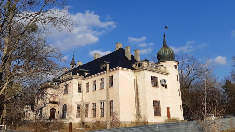
Hunting Lodges of Shuvalov
Ukraine
PalaceIntact20th century
No. 86821
Castle · Ukraine
No. 86821 · 49.078 N, 32.658 E
Quick summary
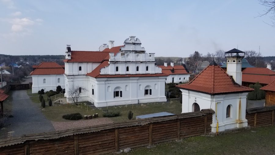
Chyhyryn Castle is a castle in Ukraine with origins associated with the 16th century.
See all castles in UkraineChyhyryn Castle in Chyhyryn, Ukraine, was raised in the late 16th century under the authority of the Polish-Lithuanian Commonwealth.
The hilltop fortress first took shape in 1589 when Cherkasy starost Oleksandr Vyshnevetsky obtained royal permission from Sigismund III Vasa to build on the rocky rise known as Stone Hill, or Kamyana Hora. In the closing decades of the 1500s the castle formed part of the southern defensive line of the Kyiv starosty. In 1593 rebellious Cossacks led by Kosiński laid siege to the place but failed to seize it.
During the mid 17th century the site passed into Cossack hands. In 1648 the castle became associated with Bohdan Khmelnytsky and functioned as the citadel of the hetman’s capital, while the hetman’s residence remained in the town. Khmelnytsky is recorded as starost of the castle from 1649 until 1657 and is said to have strengthened its defenses and increased its armament. Rebuilding and improvements continued through the 1660s and in 1664 work is attributed to military commanders Czarnecki and Sobieski. Under Petro Doroshenko the ramparts and bastions were given stone facing following an old-Italian method.
The fortress was drawn into the fighting of 1674 to 1677. Control changed hands between Ottoman forces and tsarist troops during that contest. Campaigns and sieges in 1674–1676 involved the Russian voevoda Grigoriy Romodanovsky and hetman Ivan Samoylovych. After fighting in September 1676 Petro Doroshenko resigned and the town ceased to be the hetman’s capital; a Moscow garrison was placed in the castle. Ottoman operations in the summer of 1677 caused heavy damage. A fresh siege opened on 8 July 1678. On the night of 10 August 1678 Patrick Gordon removed the garrison and destroyed the powder magazine and the artillery, an action that left the fortress ruined and unrepaired according to Ukrainian accounts. Polish accounts attribute the demolition in 1678 to Jerzy, a son of Bohdan Khmelnytsky, who is described as commanding Turkish forces.
After the blows of 1678 the town was devastated and its political and strategic role ended. In the later 18th century a new, smaller stronghold was erected after 1758 by starost Maciej Potocki on ground opposite the original hill. During the 19th century quarrying for millstones took away the western half of the hill and lowered its level by several meters. Two topographic plans made in 1678 by Patrick Gordon and a drawing appearing in the chronicle of Samiylo Velychko survive, and one of Gordon’s plans that includes the town has been rediscovered in recent years.
Perched on a steep rock above the Tiasmin floodplain the castle followed the triangular form of the hilltop. Defenses combined earth and timber works with stone facing applied in later campaigns. The summit was occupied by a broken polygonal rampart with projecting bastions and detached outworks on the approach side and the slopes. Parts of the enclosure were built in stone and other sections consisted of timber and packed earth, reflecting continuous adaptation to contemporary European fortification practices.
A lustration inventory from 1622 records a wooden palisade made of oak trunks with a roof, a wooden gate tower, and three tall wooden towers including one sited above the main entrance. The interior contained several chambers and two halls at ground level with two further halls above. Armaments listed at that time included two bronze guns cast from bells, a hackbut, four stores of gunpowder and a large quantity of shot, indicating the castle’s function as an armed stronghold and supply point.
Fortification work undertaken in the 1660s reshaped the defenses into a triangular bastion system matching the hill’s outline. In the spring of 1678 Patrick Gordon drew up and oversaw construction of an earthen crownwork called the New Upper Town, a bastioned fortification built on Dutch principles that was completed in about four months. Under Petro Doroshenko many ramparts and bastions received stone facing using an Italian-style technique; one such stone-faced bastion survives and has been restored, commonly known today as the Doroshenko bastion or the Doroshenko prison.
On the hilltop yard stood a wooden three-domed St. Nicholas church and a cluster of single-storey service buildings identified as the commandant’s house, a cordegardija, a granary and similar structures. Plans drawn by Gordon also mark several roofless wooden towers attached to the bastions; these acted as raised gun platforms where artillery could be deployed on upper decks, showing how timber and earthworked elements were used as functional gun positions.
The castle’s relationship with the town was shaped by water management. Gordon’s plan shows a dam or weir across the Tiasmin at a narrow point, forming a large pond that fed defensive moats and provided a crossing. The main access to the fortress ran over this dam and passed through an overgate tower into the town. The lower town itself was defended by an earth rampart and a water-filled moat lined with four bastions and five wooden towers in that line, demonstrating a coordinated system of town and hill defenses.
Religious and urban features survive in documentary records and in archaeological remains. A stone Peter-and-Paul church stood on a terrace below the castle; only its foundations now remain and the church served as the burial place in 1675 of Metropolitan Josyf Nelyubovych‑Tukalsky. Depictions show the Dormition and Transfiguration churches as cruciform, five-domed buildings, bell towers beside the Peter-and-Paul and Dormition churches, and a central market square with trade rows, recording the town’s ecclesiastical and commercial layout in the 17th century.
Later traces record secondary construction and scattered fragments. The post-1758 Potocki stronghold built opposite the hill consisted of two partitioned rooms and a nearby wooden tower covered with earth. Observers in 1792 noted a fragment of wall containing several iron balls and a hollow carved into the stone, interpreted as a place for storing powder. Quarrying in the 19th century removed much of the western hilltop and lowered its height, altering the surviving archaeological profile of the original fortress.
No. 50586
No. 86631
No. 92913
No. 51884
Comments
Comments for Chyhyryn Castle will require a verified account before posting.
We'll send a verification link before your first comment is published.