No. 50459
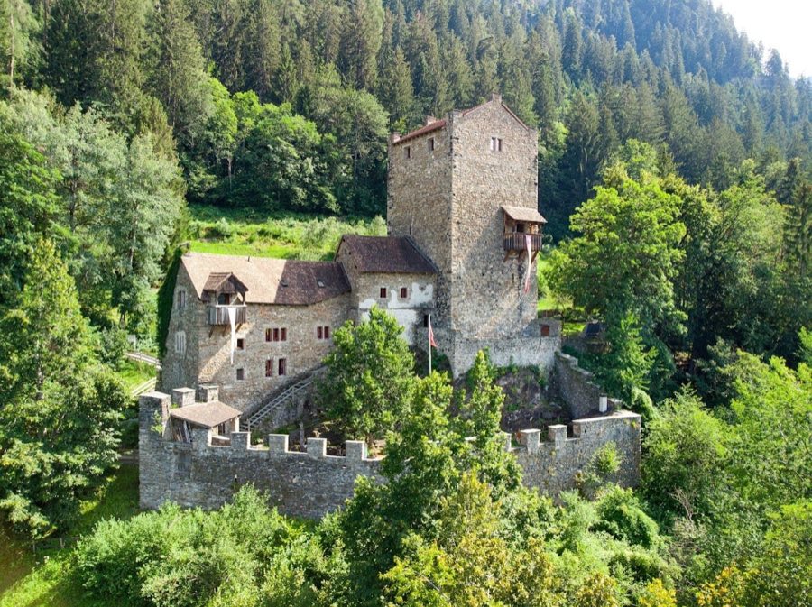
Ehrenfels Castle
Switzerland
CastleRuin13th century
No. 85144
Castle · Switzerland
No. 85144 · 46.692 N, 9.445 E
Quick summary
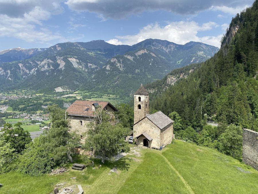
Hohenrätien (Hoch Rialt) is a castle in Switzerland with origins associated with the 13th century.
See all castles in SwitzerlandHohenrätien Castle is located in the canton of Graubünden, Switzerland; the site was first developed in the Roman era and later expanded by medieval builders.
People occupied the rocky plateau here from the Bronze and Iron Ages, and during the Roman period a religious complex took shape. Coins dated to 346 AD were found in foundation deposits, and by the fourth and fifth centuries a church and a masonry baptistery with a large baptismal font were in place. By the fourth century the surrounding region had been Christianized.
In Late Antiquity Hohenrätien belonged to the bishops of Chur and became the parish and baptismal church for the Domleschg and Heinzenberg area. The location served as the center of the large parish known as Rialt, and the bishops maintained an episcopal governor’s seat there. The plateau also functioned as a waystation on the transalpine route across the Splügen pass, providing traveller services such as lodging, mule changes, guides and storage for goods.
Fortifications and secular buildings associated with the parish governor arose in the High Middle Ages. Some defensive works were built by the eleventh century, and in the early 1200s the main residential tower on the high point was raised by two additional storeys. A defensive tower at the southeast corner was dated by tree rings to 1209. The complex combined ecclesiastical and administrative roles alongside its position on the mountain road.
A violent earthquake in 1295 caused heavy damage across the site; collapsed masonry and fallen chimneys are recorded from that event. After the earthquake many parts of the ensemble were largely abandoned and some administrative and residential functions moved to nearby Fürstenau castle. During a rebuilding phase around 1300 the church’s bell tower, which had originally stood free, was incorporated into the north wall of the nave.
Patronage rights over the church passed to Cazis Priory in 1359. Ownership later moved into private hands: the Jecklin family acquired the ruins in the late fifteenth century (sources give about 1472 or inheritance by 1480), and the property passed by inheritance to von Hohenrealta in 1581. The last resident parish priest left Hohenrätien in 1505, ending a baptismal tradition that had continued for more than a millennium.
Conservation and archaeological work began in the twentieth century. Initial stabilisation took place in 1970–71, a family foundation and an associated support group became active from the early 1970s, and the priest’s tower was restored in 1975. The nave and roofs of the church were repaired and fitted with a simple wooden floor in 1980, and the main tower interior received reinforcement in 1990–91. Systematic excavations by the cantonal archaeological service were carried out between 1999 and 2005, with further archaeological work in 1997 and 2001. Hohenrätien Castle is listed as a Swiss heritage site of national significance, and since December 2025 it is recorded as being in the possession of the Hohen Rätien – Stiftung von Jecklin.
The ensemble occupies a rocky plateau of about one hectare on the Crap Sogn Gion / Johannisstein at roughly 946 metres above sea level, the rock face dropping about 250 metres to the Viamala valley below. Steep cliffs protect three sides of the plateau and the only approach is from the south by a saddle some forty metres lower. The site is split into an outer sacred zone around the church and a more densely built inner secular quarter. A partially visible surrounding wall, probably dating to the Early Medieval period, encloses parts of the plateau, and ground-penetrating radar has revealed buried structures beneath the surface.
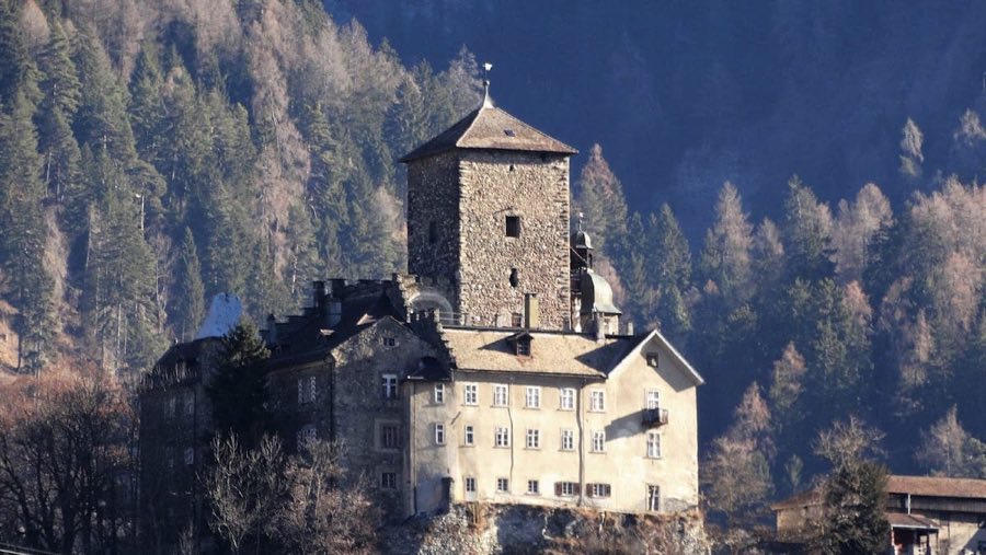
At the highest point stands the ruin known as Hoch Rialt, the main residential tower. The masonry preserves the building to about fourteen metres high and the stonework records an original two-storey house that was heightened by two extra storeys in the early 1200s. A high entrance, later blocked, led into a guest room that contained a latrine, and an upper floor held a large open fireplace after the thirteenth-century extension. A cistern cut into the bedrock beneath the tower collected rainwater from the gabled roof; its capacity has been estimated at about thirty thousand litres. The east wall shows damage consistent with debris from the earthquake of 1295 when a chimney collapsed into the interior. Modern interventions inside the tower include a gallery-like support structure, a light-permitting roof feature with a glass pyramid, and a rainwater spout at the third-floor level.
The Church of St. Johann and Viktor occupies the eastern edge of the plateau beside the entrance. Archaeological layers show this building to be the latest stage in a long sequence of sacred constructions that began in Late Roman times. The plan preserves a long nave with a slightly angled rectangular choir to the east. The bell tower originally stood free as a campanile before the earthquake of 1295 and was integrated into the church’s north wall during rebuilding around 1300. During 1980 the church received a new roof and a plain wooden floor to conserve the interior.
Northwest of the church the priest’s tower, known as the Pfaffenturm, is a square, three-storey masonry building whose fabric records five distinct construction and alteration phases. Restoration in 1975 returned the tower to a form with a gabled roof and it has been used as accommodation by the family foundation and its support association. The tower stands in restored condition and shows the sequence of changes it underwent over the centuries.
On the south-east edge of the enclosure a defensive tower dated by dendrochronology to 1209 rises from two-storey masonry. Evidence shows a single-storey wooden overbuild once projected from its upper level and served as living space. Charred beam fragments and a missing south-eastern corner record severe burning and structural loss consistent with violent destruction in the late thirteenth century.
Excavations northeast of the standing church uncovered an early sacral complex and an attached baptistery. Coins of 346 AD were found in foundation contexts that date these layers to the fourth century, and the baptistery contains a large masonry baptismal font attributable to the fourth or fifth centuries. Medieval building phases preserved access routes to that ancient font, showing continuity of ritual use across many centuries. The baptistery and associated foundations survive in situ as archaeological features.
East of the church a long building produced fragments of beaker-shaped stove tiles, an early form of tile stove, and this structure is interpreted as a xenodochion, a guest house for higher-status travelers with direct access toward the church. The tile fragments and the building’s layout document its function and relationship to the sacred complex.
Throughout the inner enclosure rock-cut water installations and other service features attest to long-term habitation. A cistern hewn into the bedrock under the main tower and fed by roof runoff lies within the castle’s core. Modern conservation has added a glass roof over the main tower and wooden platforms at original floor heights around the tower walls while leaving the central chamber open to light, measures that stabilise and present the surviving fabric.
No. 50459
No. 95008
No. 72102
No. 17007
Comments
Comments for Hohenrätien (Hoch Rialt) will require a verified account before posting.
We'll send a verification link before your first comment is published.