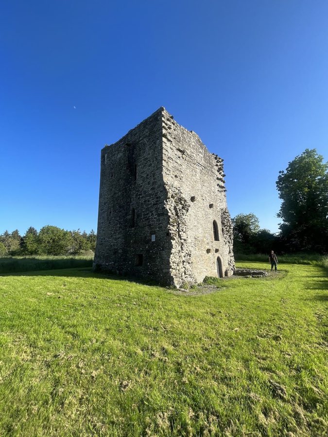
No. 12648
Threecastles Castle
Ireland
Tower houseIntact16th century
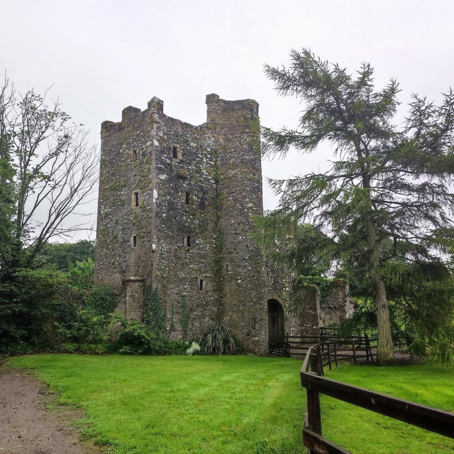
No. 46977
No. 46977 · 53.233 N, 6.527 W
Quick summary
Kilteel Castle is a castle in Ireland with origins associated with the 12th century.
See all castles in IrelandKilteel Castle stands in the village of Kilteel, Ireland. The site was developed in the medieval period by the Knights Hospitallers and later by local Anglo‑Irish builders.
The place has a long human story before the medieval castle. A prehistoric burial mound crowns Kilteel Wood and was said locally to have been a coronation place for regional kings and clan leaders. In the early medieval era the lands belonged to the Mac Brennan family of the Fothairt Airthir, with the chief’s residence at Rathmore and the main church for that group nearby. A church at Kilteel was attributed to the seventh‑century bishop Célé Crist and is mentioned in a papal letter of 1179. Another early ecclesiastical name recorded at the site is Kildronan, also called Cell Epscoip Drónáin. Excavations have recorded two churches, a monastery, and a rounded, D‑shaped fortification from this period.
From the later twelfth century the estate belonged to the Order of the Knights Hospitallers. The order is reported to have built a stronghold at Kilteel in 1212, and foundations from that phase survive in the ground around the later tower. Around 1400 a new stone tower was raised on the site, forming the core of the building that survives today.
Kilteel’s position placed it on the southwest edge of the Pale, the English controlled territory, and it formed part of that border’s defenses. The settlement and castle were subject to repeated Gaelic attacks over several centuries, notably from the O’Byrne and O’Toole clans. Royal letters addressed to Kilteel include a document from Edward III in 1335, and later acts confirmed the Pale boundary around 1488 and again in 1494–95. The castle was burned or assaulted by Rory O’More in 1573 and again in 1574. In 1580 Fiach Mac Hugh O’Byrne led an attack that was repelled by a garrison described as fifty horse and one hundred foot, and the castle was attacked again in 1595 by his son.
The Reformation brought the dissolution of local monastic holdings and transfer of lands into private hands. Holdings around Kilteel passed to the Alen family of Norfolk; John Alen was appointed Lord Chancellor of Ireland in 1536. Documentary references record members of that family, including Thomas, John and Robert Alen, in the mid‑sixteenth to early seventeenth centuries. By 1669 the castle was in the possession of the Earl of Tyrconnell and the estate supported a range of tenants during the seventeenth century. The castle and lands were confiscated in the turmoil of the Jacobite and Williamite wars.
Ownership continued to change in the following centuries. A company acquired the property in 1703 and William Fownes purchased it in 1706. In the nineteenth century John Kennedy bought the castle and estate in 1838, and later in that century estate lands were sold to tenants under the land acts. Visual images of the site survive from the nineteenth century, including an Edwin Rae drawing and an 1833 Dublin Penny Journal illustration that shows the house with steep gables. In 1901 a probable seventeenth‑century cannon ball was found near the castle.
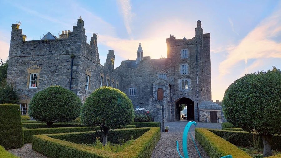
The site is dominated by a stone tower of five storeys that dates to around 1400. This rectangular tower is built of masonry and retains vaulted ceilings over the ground floor and at least one upper level, with vaulted work specifically recorded on the third floor. Underground spaces, described as cellars, lie beneath parts of the building. A gatehouse or entrance block is attached to the tower on its south‑west side, and the broader defensive enclosure that once surrounded the complex is recorded as having been present.
Beneath and beside the later tower are structural traces from an earlier medieval castle attributed to the Knights Hospitallers, with masonry foundations that are thought to belong to the reported stronghold of about 1212. These remains lie within the footprint of the later fortification and show the long sequence of reworking on the site.
Close to the tower stand the ruins of a Romanesque stone church. The church is described as an early stone building, with carved stone sculpture elements that were later removed and incorporated into other ecclesiastical sites. A large stone high cross associated with King Diarmait Mac Murchada is recorded as part of the churchyard setting. The church fabric and sculptural fragments survive in ruinous condition, with some carved stones preserved elsewhere.
A prehistoric tumulus survives on the summit of Kilteel Wood immediately adjacent to the castle complex; this earthen mound is visible on the ridge and carries the local tradition that it served in coronation rites for regional rulers. Southeast of the medieval church an earthwork interpreted as part of the Pale boundary runs across the landscape. Aerial photographs show traces of an earthen bastion in that area, and the boundary earthwork continues eastward where it helps form the dividing line between the townlands of Kilteel Upper and Cupidstown.
Later documentary and visual records relate to the site’s material remains. Nineteenth‑century images, including an undated Edwin Rae drawing and the 1833 journal engraving, record the castle’s roofline and gabled profile at that time. A probable seventeenth‑century cannon shot found in 1901 near the castle adds a tangible link to the episodes of armed conflict that affected the place.
No. 12648
No. 35975
No. 77655
No. 75333
Comments
Comments for Kilteel Castle will require a verified account before posting.
We'll send a verification link before your first comment is published.