No. 47328
Stadtlengsfeld Castle
Germany
CastleRuin12th century
No. 44599
Castle · Germany
No. 44599 · 50.837 N, 10.129 E
For rent
Krayenburg is marked for bookable castle accommodation. Nightly pricing, sleeps count, stay rules, and amenities are displayed only when public operator data is available.
Rental type: Hotel / bookable stay, Short-stay rental
Short-term availability: Bookable accommodation signal
Quick summary
Krayenburg is a castle in Germany with origins associated with the 12th century.
See all castles in GermanyKrayenburg is located in the municipality of Tiefenort in modern Germany; the hilltop stronghold was created by Hersfeld Abbey, a Carolingian monastic institution.
On the ridge east of the castle there are visible earthworks that predate the medieval site, and in the eighth century Charlemagne granted the nearby village of Dorndorf and its belongings to Hersfeld Abbey. The abbey established the Krayenburg to guard those possessions. The castle appears in surviving documents from 1155 as a fortified place belonging to Hersfeld Abbey.
In November 1184 Pope Lucius III issued a decree in favour of Abbot Siegfried that among other measures forbade further feudal grants of the Krayenburg. The next day Emperor Frederick I issued a confirming act that released the castle and neighbouring villages from the royal right to seize property, reinforcing the abbey’s control. During the high medieval period a local noble line, the von Frankenstein family, held the castle as a fief from Hersfeld Abbey and expanded the complex in the Romanesque style; in 1270 Margaretha von Staufen took refuge there.
Ownership passed through contested hands in later centuries. A dispute with the abbey at Fulda and other transfers led Hersfeld Abbey to pledge the Krayenburg and its lands to the Thuringian landgraves in 1407. From 1516 until 1567 the counts von Beichlingen were the feudal holders; Adam von Beichlingen, who died on 7 August 1538, is recorded among the owners and is buried in the church at Tiefenort. In 1567 the site came under the Ernestine line of Saxon rule and, after territorial reorganisations beginning in 1596, belonged to the duchies of Saxony-Eisenach and later Saxony-Weimar-Eisenach.
From 1567 until 1879 the castle functioned as the administrative centre for the surrounding district known as the Krayenburg office. The Thirty Years’ War brought decisive damage: in 1640 Croatian troops in imperial service entered and plundered the castle, after which it fell into ruin and was used locally as a quarry for building stone. The official district seat moved to Tiefenort in 1703 and thereafter only a forester lived at the ruined site.
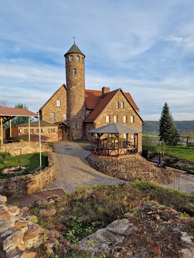
In 1782 Johann Wolfgang von Goethe visited and made a drawing of the Krayenburg. In 1850 decorative Romanesque columns from the palas window openings were removed and re-erected in the commandant’s garden at the Wartburg. During the 1920s the local community added a small sandstone building with a hall and lodging and built a round viewing tower, which was later heightened. After the Second World War the site became public property; under the East German administration it served as a party school and a youth work centre, and a notable transmission installation of the postal service was erected on the hill. Following German reunification a local association was re-established and took part in repair work and the conversion of parts of the location for a guesthouse, restaurant and hotel. In the 1990s the unstable palas was given structural support and initial archaeological investigations were carried out. The site is now protected as a ground and building monument in the municipality of Tiefenort.
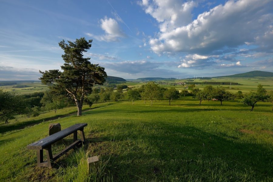
The Krayenburg occupies the cone-shaped summit of the Krayenberg at 428.3 metres above sea level and commands steep slopes into the Werra valley on three sides. The plan of the site reflects a summit castle adapted to the narrow hilltop, with an inner and outer defensive circuit and a core bailey aligned along the ridge. The hill is reached from the east by an access road of approximately 1,500 metres from Tiefenort and by footpaths from nearby villages, and the castle platform overlooks the townships below.
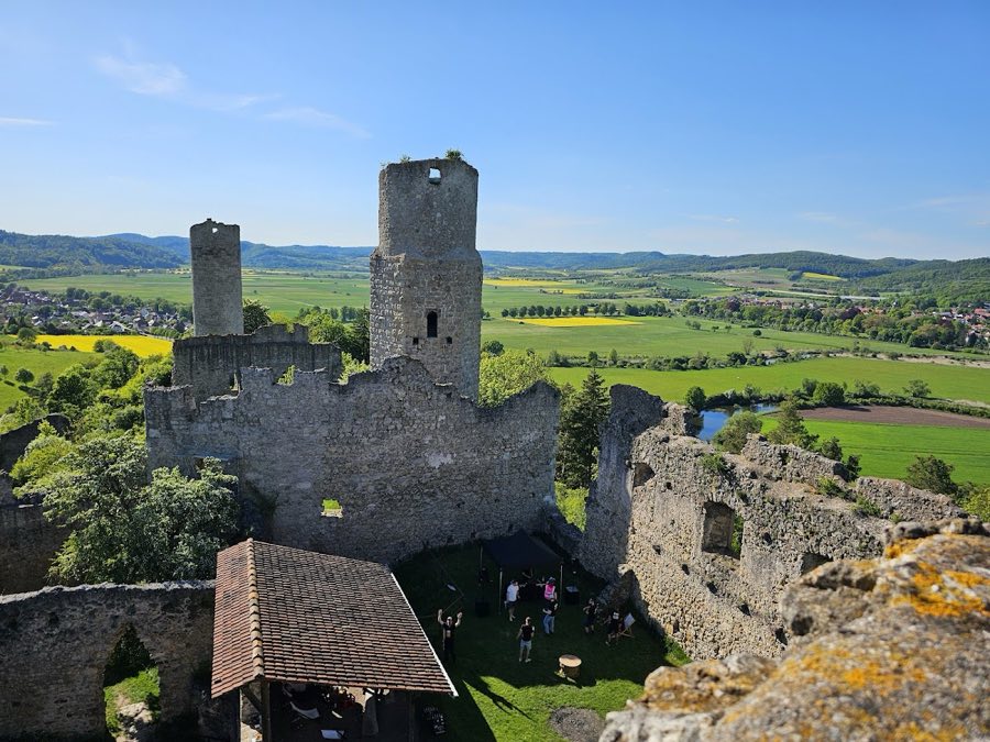
The main residential building, the palas, survives in part. The north wall of the palas remains standing and sections of its structure are archaeologically confirmed, while additional fragments of the palas fabric were found to be statically unstable and were stabilised in the 1990s. Vaulted cellars associated with the principal building survive and have been documented in situ. A cistern that once supplied the castle is also present among the surviving substructures. These elements are constructed of the local stone typical of medieval fortifications and today are fragmentary but conserved.
Defensive walls survive in sections. Parts of the inner and outer ring walls remain in place, together with traces of the core bailey’s rampart and ditch that mark the bailey’s limits. Along the approach to the castle there are remains of a tiered, sectional fortification that follows the access route up the hill, indicating deliberate control of the approach. These earthworks and wall fragments illustrate how defenders shaped the ascent and are visible on the route from the east.
About two hundred metres east along the same ridge lie clearly visible remains of an older wall construction, often referred to as a fortified ridgework. This older fortification is recorded as possibly prehistoric and stands apart from the later medieval castle, indicating successive phases of defensive use on the ridge. The relationship between the earlier wall and the medieval stronghold is evident in their proximity and the differing construction character of the two sites.
Modifications and later additions are evident across the site. In 1850 Romanesque column shafts from the palas window openings were dismantled and placed in the Wartburg’s commandant garden, demonstrating 19th‑century reuse of sculptural elements. In the 20th century a sandstone lodging building with a hall was erected near the ruins and a round observation tower was built in the 1920s and subsequently heightened; transmission installations and antenna masts were also installed on the hill and in the northern part of the castle area during the modern period. Today the castle stands as a ruin with limited original fabric, its medieval masonry conserved in places, the palas reinforced, and the site managed with later structures retained alongside the archaeological remains.
No. 47328
No. 81240
No. 80710
No. 49354
Comments
Comments for Krayenburg will require a verified account before posting.
We'll send a verification link before your first comment is published.