No. 57262
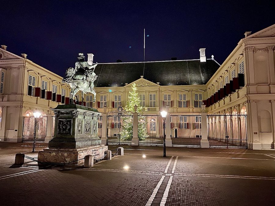
Noordeinde Palace
Netherlands
PalaceRestored14th century
No. 28679
Castle · Netherlands
No. 28679 · 51.918 N, 4.403 E
Quick summary
Huis te Riviere, Schiedam is a castle in Schiedam, Netherlands with origins associated with the 13th century.
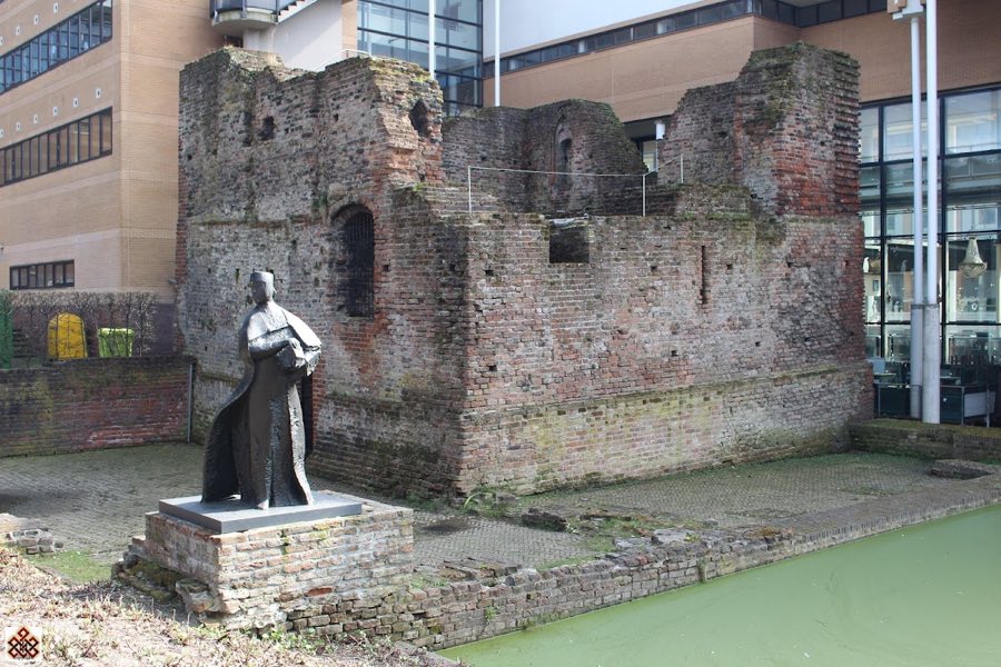
See all castles in NetherlandsHuis te Riviere in Schiedam, Netherlands, is a medieval castle founded in the mid-13th century by Aleid (Adelaide) of Holland and belongs to the built heritage of the County of Holland. Construction began in the 1260s and the site belongs to the medieval fortified-residence tradition. The place became locally important early on: it appears in written records from 1268 under a name meaning the house by the new Schie, and on 18 March 1275 Aleid granted city rights to a newly founded town beside the castle, tying the site to regional urban development. The nearby lordship of Mathenesse, which gave the castle one of its alternate names, had been acquired by Aleid in 1260.
Work and use continued through the late 13th century. In 1276 Aleid granted the abbey of Koningsveld the right to place one of its brothers in the castle chapel in return for an annual payment, establishing a formal religious link for the household chapel. Ownership and feudal tenure changed in the 14th century: in 1339 the castle was given as a fief to Knight Dirk of Matenesse, with hereditary rights to his sons. After Dirk’s death in February 1345 the fief passed to his brother Daniël in May 1345, and in September 1346 the holding was confirmed as hereditary for their family.
The mid-14th century was turbulent. During the Hook and Cod Wars the castle fell to the Cod faction before 25 March 1351, and citizens of Schiedam tore down much of the large fortress, leaving only the central keep and a large mound of debris. In the years that followed parts of the complex were rebuilt and by about 1350 the site was occupied, although work appears to have continued. Ownership remained in the Matenesse family, and later medieval records show further rebuilding and modification to the living quarters.
Violence returned in 1426 when forces under Willem Nagel attacked the place; contemporary accounts record it as having been plundered or destroyed by those forces, after which the building was restored to a more habitable condition. The castle suffered a final, catastrophic blow in 1574 during the Eighty Years’ War. Republican troops caused two separate fires within the stronghold and local inhabitants pulled down the walls; the upper portion of the tower was demolished in 1574 and the building ceased to function as a noble residence.
In the 20th and 21st centuries the ruined site has been examined and partially uncovered in phases of excavation and intervention, producing plans of its surviving structures and prompting reassessments of its early layout. In the late 20th century an artwork honoring Aleid was placed at the ruin, and municipal planning in the early 21st century has proposed measures to make the remaining masonry more visible in the townscape.
The surviving ruins occupy a compact footprint approximately 20 by 17.5 metres and consist chiefly of the lower portion of the main tower and the foundations of adjacent walls. The principal tower stood as a freestanding, square keep with a base roughly 12 by 12 metres, set inside a larger almost-square castle of about 45 by 50 metres begun in the 1260s. A small internal moat separated the tower from the nearby buildings at the northwest corner, indicating the keep formed a defended inner position within the wider enclosure.
Beneath the tower a high vaulted cellar survives. The cellar was closed by a barrel vault (a semi-cylindrical vaulted ceiling) and the thick masonry there exceeds three metres in places. Small light openings pierced the walls, measuring only about 12 centimetres on the exterior but widening to roughly 95 centimetres on the interior, a design that admitted light while keeping the basement secure. During construction the eastern side of the cellar settled unevenly and builders corrected the footing by adding a layer of cut bricks to level the floor. Much of this substructure remains in situ.
The ground floor and its fittings reveal domestic and service functions. Ground-floor wall thickness reached about 1.40 metres and the room layout included windows in the south and east walls, with evidence for a west-facing opening as well. A garderobe, or privy, stood on the south side and a niche held a lavabo with a red-stone sink for washing. A fireplace occupied the north wall. Access between levels continued by an internal stair, and painted depictions from around 1574 show a stair feature projecting at first-floor level. Above the first floor the roof was hipped and carried merlons (the solid uprights of battlements), indicating an appearance that combined domestic roofing with defensive parapets. Later openings cut into the masonry now provide direct access to the cellar and to the stair that led up to a northern wing at ground-floor level.
Remains of adjacent wings and the fortified outer courtyard survive as foundation lines and low wall fragments. The wing to the north of the tower measured about 8 by 17.5 metres, while a southwestern compartment measured roughly 12.5 by 5.5 metres. Foundations and historical depictions show stepped gables facing west on the northern and southwestern ranges, and a painted view around 1574 corresponds with that arrangement. The curtain wall that surrounded the inner castle survives in parts and shows internal buttresses placed very close to the main tower. Similar stretches of wall appear on the western edge of the forework, and masonry traces show the enclosure wall projecting into the surrounding water in places.
Building materials and workmanship record changes in the construction sequence. Foundation bricks are generally about 28 centimetres long and 7.5 to 8 centimetres thick, with occasional examples reaching 31 to 32 centimetres. Above the basement the brickwork is predominantly red, while lower courses include many yellowish bricks, a contrast that marks a break in building phases. Interpretations of the early plan include a central keep linked to a ring wall, a slightly skewed corner tower, and the possible presence of a covered walkway or bridge between the keep and another tower. The forework shows parallels with contemporary fortified courtyards elsewhere in the region, and a historic map depicts a connecting passage between the main castle and an adjoining court.
Today the ruin stands as a fragmentary remnant of the medieval complex, the upper parts of the tower having been removed in 1574. The masonry sits adjacent to the municipal town hall complex, which was extended close to the site, and the remains can be seen from public roads. Excavations in the 20th century uncovered plan details of the tower and parts of the outer courtyard and informed later conservation and town-planning proposals for the surviving fabric.
No. 57262
No. 54301
No. 34117
No. 69305
Comments
Comments for Huis te Riviere, Schiedam will require a verified account before posting.
We'll send a verification link before your first comment is published.