No. 66736
Ruiny zamku w Kryłowie
Poland
CastleRuin17th century
No. 27891
No. 27891 · 51.167 N, 23.348 E
Quick summary
Stołpie (Стовп'є) is a castle in Poland with origins associated with the 13th century.
See all castles in PolandStołpie, recorded in medieval sources under the Cyrillic form Стовп’є, lies in the modern municipality of Stołpie in Poland and was created within the Old Rus’ polity of Volhynia. It first appears in regional affairs in the late twelfth and early thirteenth centuries. The Galician–Volhynian Chronicle notes the site under the year 6712 (corresponding to 1208 or 1210) in an account of Kraków prince Leszek the White compelling Prince Oleksandr Vsevolodych to cede certain settlements, including Стовп’є, to Prince Vasilko Romanovych; those places were later retaken in 1217–1218 by Prince Danilo Romanovych. The place-name continues to occur intermittently in documents through the fourteenth to the sixteenth centuries.
The stronghold was likely established as a border fortress between Volhynia and neighbouring Polish lands at the turn of the twelfth and thirteenth centuries, during the rule of Prince Roman Mstyslavich. In the 1230s the complex underwent major rebuilding and for a time appears to have functioned as a fortified monastery. One hypothesis identifies the site with the monastery-residence of Roman Mstyslavich’s widow, Anna, who became a nun in the 1220s and died in 1253 or 1254. A further phase of construction began in the 1280s, when fortifications and buildings were enlarged amid renewed tensions within the Romanovych dynasty and with Polish princes. At the turn of the thirteenth and fourteenth centuries a destructive fire damaged the complex, which was not rebuilt thereafter. Archaeological investigations carried out in 2003–2005 have helped to reconstruct the sequence of occupation and transformation at the site.
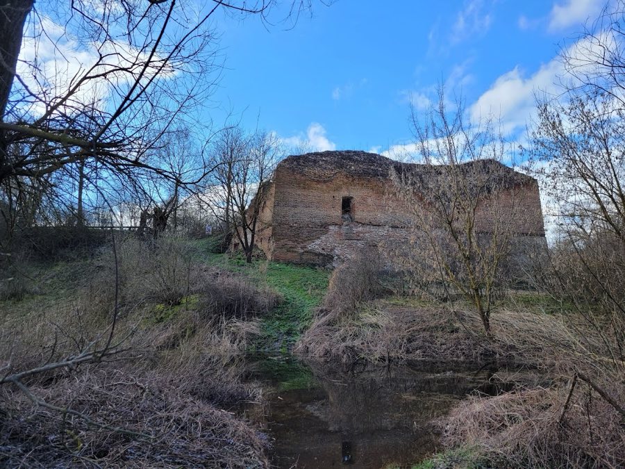
The site is laid out as a hillfort centred on an earthen mound, with a substantial masonry tower set immediately beside that mound. The surviving plan and fabric combine earthwork defences with dressed stone and brick construction, reflecting the place’s alternating roles as a defensive position and a religious house.
The mound rises roughly four to five metres above the surrounding ground and covers more than four hundred square metres. Excavation has confirmed its function as the principal stronghold platform, preserving traces of enclosures and the footprints of contemporary buildings; the earthwork remains the dominant topographic feature on site.
The masonry tower stands adjacent to the hill and has a rectangular outer footprint measuring about 5.7 by 6.3 metres, while its interior plan is circular. The standing walls reach up to approximately 19.5 metres. Built in multiple storeys, the tower contains four levels; the topmost floor is laid out as an eight-sided chamber with an apse that served as a chapel. The tower’s form and vertical sequence reflect rebuilding and adaptation in the thirteenth century and later. Although the settlement was not reconstructed after the major fire at the turn of the thirteenth and fourteenth centuries, the masonry fabric and the preserved elevation of the tower remain visible on site.
No. 66736
No. 34482
No. 66218
No. 10169
Comments
Comments for Stołpie (Стовп'є) will require a verified account before posting.
We'll send a verification link before your first comment is published.